
Length 78 km | ||
 | ||
River mouth Confluence with East River8,005 ft (2,440 m) Sources Castle Peak, Gunnison County, Colorado | ||
The Taylor River rises close to Castle Peak in Colorado’s Elk Mountains in the northeast part of Gunnison County, near the Continental Divide. Flowing southeast, the river goes through Taylor Park Reservoir, created by the Taylor Park Dam. From there it flows southwest. At Almont, the Taylor River joins with the East River to form the Gunnison River. The river is 48.2 miles (77.6 km) long.
Map of Taylor River, Colorado, USA
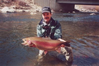
Most of the river lies within the Gunnison National Forest. It is a popular river for fly fishing of trout and for whitewater rafting.
References
Taylor River (Colorado) Wikipedia(Text) CC BY-SA