
Website tavertet.cat Area 32.5 km² Local time Monday 3:15 PM | Elevation 869 m Population 125 (2014) | |
 | ||
Weather 9°C, Wind E at 10 km/h, 68% Humidity | ||
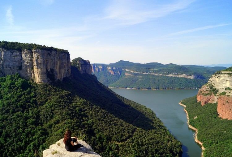
Tavertet is a small town located above some cliffs, 900m above sea level, in the area known as Collsacabra, north of the Guilleries, in the comarca of Osona in Catalonia.
Map of 08511 Tavertet, Barcelona, Spain
Below the cliffs is Pantà de Sau, a reservoir that dammed the waters of the river Ter in the 1960s. Tavertet is nowadays a tourist-oriented town with many holiday homes, where Raimon Panikkar lived. Tavertet is linked by road BV5207 to the town of L'Esquirol, also known as Santa Maria de Corcó. There is also a minor road north of the village above the cliffs through a beech forest linking the town to Rupit.
References
Tavertet Wikipedia(Text) CC BY-SA