
Population 80 Sovereign state United Kingdom Local time Monday 4:11 AM | OS grid reference ST937058 Post town BLANDFORD FORUM | |
 | ||
Weather 4°C, Wind NE at 11 km/h, 92% Humidity | ||
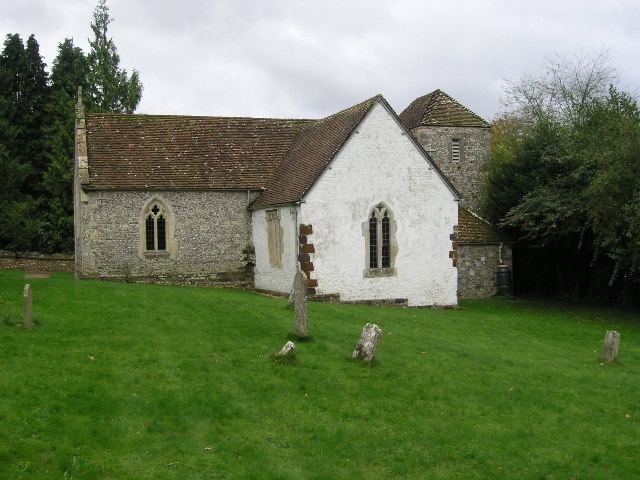
Tarrant Rushton is a village and civil parish in north Dorset, England. The village is situated in the Tarrant Valley about 3 miles (4.8 km) east of Blandford Forum. In 2013 the civil parish had an estimated population of 80. Starting in the north east the parish adjoins Moor Crichel, Witchampton, just touches Wimborne Minster to the east, then Shapwick, Tarrant Crawford,Tarrant Keynston and Tarrant Rawston. The ancient church of St Mary is built of flint and stone and parts of it date from Norman times. The church accommodates 120 persons and the registers date from 1700.
Map of Tarrant Rushton, Blandford Forum, UK
At one time there was a hospital or charity in the parish dedicated to St Leonard. There has not been a post office in the parish but there was a parish school which in 1895 catered for 45 children. Abbey Crofts which in the 1890s had a population of 7 was transferred to Tarrant Crawford. The population in 1891 was 177. The 2073 acres are light loam and used to be mainly for cultivation of wheat. In more recent times the airfield at Tarrant Rushton played a vital role in World War II and more information on this is available on the Tarrant Rushton Airfield site.
To the east of the village is Tarrant Rushton Airfield built during World War II and in use until 1980.