
Established 1934 Elevation 630 m Local time Monday 2:07 PM | Postcode(s) 7140 Mean max temp Mean min temp Founded 1934 Postal code 7140 | |
 | ||
Location 126 km (78 mi) NW of Hobart137 km (85 mi) E of Queenstown91 km (57 mi) NW of New Norfolk Weather 18°C, Wind W at 19 km/h, 76% Humidity | ||
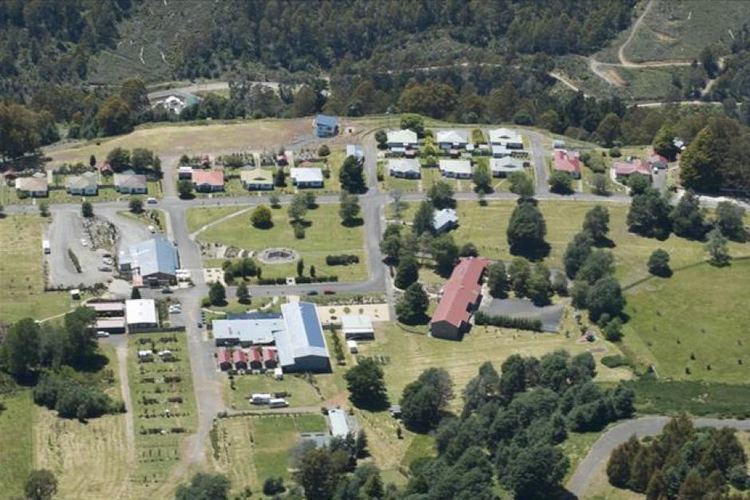
Tarraleah is a small town in the Central Highlands of Tasmania 126 km north-west of the state capital Hobart, and slightly closer to Queenstown.
Map of Tarraleah TAS 7140, Australia
The township was built in the 1930s by the Hydro Electric Commission to house Tasmania's pioneering hydro electricity officers and management.
The Post Office opened on 11 October 1934, and was named Tarraleah in 1935.
The area is noted for its alpine lakes and mountains, and many hydro-electric dams, canals and giant steel pipeways. Tarraleah is located along the Lyell Highway, and is only a short distance from both Lake King William and Bronte Lagoon. Lake Lipootah and Bradys Lake are also close by.
After a multimillion-dollar redevelopment, the former Hydro construction village has become an estate that comprises Tarraleah Lodge with accommodation, recreation, and dining options. Fresh water trout fishing, boating, bushwalking, mountain biking and kayaking are all popular activities in and around the township.
Tarraleah is also home to a high altitude golf course.