
Country Cape Verde | Island São Nicolau Area 121.5 km² | |
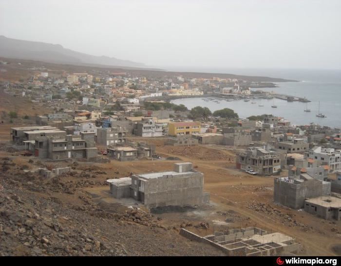 | ||
Tarrafal de São Nicolau is a concelho (municipality) of Cape Verde. Its 2010 population was 5,205, a third live in the municipal seat and the area is 119.8 km². Situated in the western part of the island of São Nicolau, it covers 35% of the island area, and is home to 41% of its population. Its capital is the town Tarrafal de São Nicolau.
Contents
Map of Tarrafal de Sao Nicolau, Cape Verde
Subdivisions
The municipality consists of one freguesia (civil parish), São Francisco de Assis. The freguesia is subdivided into the following settlements, its population was of the 2010 census:
History
The municipality was created in 2005, when the older Municipality of São Nicolau was split in two, the western part becoming the Municipality of Tarrafal de São Nicolau and the eastern part becoming the Municipality of Ribeira Brava.
Sports
Its football (soccer) stadium is Estádio Orlando Rodrigues.
The clubs include AJAT'SN, FC Ultramarina, and Praia Branca
Politics
The Installation Commission was the power of the newly formed municipality, the transitional council between the creation and 2008. Between the first elections in on May 18, 2008 up to 2012, the PAICV was the leader of the municipality, the MpD is now the leader of the municipality. Of the 13 seats, 7 are of the Mpd party in the assembly, in the chamber, all five seats are taken by the MpD.