
Country United States FIPS code 39-76148 Elevation 275 m Zip code 43156 Local time Sunday 9:48 PM | Time zone Eastern (EST) (UTC-5) GNIS feature ID 1061673 Area 109 ha Population 285 (2013) Area code 740 | |
 | ||
Weather 13°C, Wind S at 8 km/h, 97% Humidity | ||
Tarlton is a village in Fairfield and Pickaway counties in the U.S. state of Ohio. The population was 282 at the 2010 census.
Contents
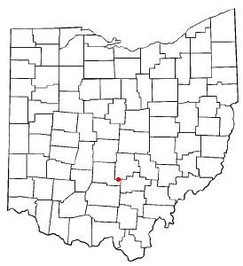
Map of Tarlton, OH, USA
History
"Currently, Tarlton is located on the line of Pickaway and Fairfield Counties in Ohio (Tarlton, 1990). It is approximately 20 minutes away from the city of Lancaster and approximately 15 minutes from the city of Circleville (Google Maps, 2015). Tarlton is currently considered to be part of Pickaway County, but this has not always been the case (Weaver, 1999). Originally, when Tarlton was founded, it was part of Fairfield County, it was not until Pickaway County, was erected on March 1, 1810, that it became part of Pickaway County (Weaver, 1999). Tarlton was founded by Mr. Benjamin Newell in 1801, while Ohio was still a part of the Northwest Territory prior to its admission to the Union in 1803. Tarlton was not officially established until 1804, after Ohio joined the Union (Tarlton, 1990). This makes Tarlton, undoubtedly, one of the oldest settlements in Pickaway County that is still standing today (Tarlton, 1990). When Mr.Benjamin Newell originally founded the Village of Tarlton, it was named after him (Weaver, 1999). Tarlton was originally named Newellstown (Weaver, 1999). Sometime between 1804 and 1816, the name of this village changed from Newellstown to Tarleton (Weaver, 1999). This was in honor of General Banastre Tarleton, a commander of a detachment of British troops in the Battle of Cowpens near King’s Mountain in South Carolina (Tarlton, 1990). This action of changing the village’s name to honor General Banastre Tarleton is said that this name change has occurred because of the Tory Sentiment in the Community (Tarlton, 1990). Later, the village’s name was changed from Tarleton to Tarlton, dropping the letter E from its name (Tarlton, 1990). No one really knows when the letter E was dropped from its name and it is also unclear why the letter E was dropped (Tarlton, 1990). Tarlton’s early settlement undoubtedly shows Tarlton's rich and crazy history."
The Cross Mound is nearby, which was built by the pre-Columbian Mound Builders.
Geography
Tarlton is located at 39°33′17″N 82°46′45″W (39.554697, -82.779176).
According to the United States Census Bureau, the village has a total area of 0.42 square miles (1.09 km2), all land.
Tarlton's elevation is 902 feet above sea level.
Tarlton is 30 miles southeast of Columbus.
2010 census
As of the census of 2010, there were 282 people, 100 households, and 77 families residing in the village. The population density was 671.4 inhabitants per square mile (259.2/km2). There were 115 housing units at an average density of 273.8 per square mile (105.7/km2). The racial makeup of the village was 98.9% White, 0.7% African American, and 0.4% from two or more races. Hispanic or Latino of any race were 2.8% of the population.
There were 100 households of which 41.0% had children under the age of 18 living with them, 58.0% were married couples living together, 14.0% had a female householder with no husband present, 5.0% had a male householder with no wife present, and 23.0% were non-families. 18.0% of all households were made up of individuals and 10% had someone living alone who was 65 years of age or older. The average household size was 2.82 and the average family size was 3.23.
The median age in the village was 39.2 years. 27% of residents were under the age of 18; 8.4% were between the ages of 18 and 24; 22.3% were from 25 to 44; 31.9% were from 45 to 64; and 10.3% were 65 years of age or older. The gender makeup of the village was 47.5% male and 52.5% female.
2000 census
As of the census of 2000, there were 298 people, 102 households, and 75 families residing in the village. The population density was 710.2 people per square mile (273.9/km²). There were 120 housing units at an average density of 286.0 per square mile (110.3/km²). The racial makeup of the village was 100.00% White.
There were 102 households out of which 38.2% had children under the age of 18 living with them, 56.9% were married couples living together, 8.8% had a female householder with no husband present, and 25.5% were non-families. 23.5% of all households were made up of individuals and 13.7% had someone living alone who was 65 years of age or older. The average household size was 2.92 and the average family size was 3.39.
In the village, the population was spread out with 31.2% under the age of 18, 7.4% from 18 to 24, 30.5% from 25 to 44, 19.8% from 45 to 64, and 11.1% who were 65 years of age or older. The median age was 36 years. For every 100 females there were 101.4 males. For every 100 females age 18 and over, there were 107.1 males.
The median income for a household in the village was $31,875, and the median income for a family was $43,125. Males had a median income of $30,938 versus $25,625 for females. The per capita income for the village was $13,379. About 9.0% of families and 6.0% of the population were below the poverty line, including 1.1% of those under the age of eighteen and 22.5% of those sixty five or over.