
Length 144 km | Bridges Đurđevića Tara Bridge | |
 | ||
Sources Veruša River, Opasnica River Countries Montenegro, Bosnia and Herzegovina Similar Đurđevića Tara Bridge, Piva, Drina, Biogradska Gora, Lake Skadar | ||
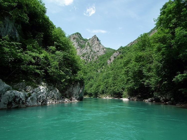
The Tara (Cyrillic: Тара) is a river in Montenegro and Bosnia and Herzegovina. It emerges from the confluence of the Opasnica and Veruša Rivers in the Komovi Mountains, part of Dinaric Alps of Montenegro. The total length is 144 km, of which 104 km are in Montenegro, while the final 40 km are in Bosnia and Herzegovina; it also forms the border between the two countries in several places. The Tara flows from south to north - north-west and converges with the Piva at the Bosnia and Herzegovina and Montenegro border between the villages of Šćepan Polje (Montenegro) and Hum (Bosnia and Herzegovina) to form the Drina river (a branch of the Danube watershed).
Contents
Map of %D0%A2%D0%B0%D1%80%D0%B0
The Tara River cuts the Tara River Canyon, the longest canyon in Montenegro and Europe and second longest in the world after Grand Canyon, at 78 kilometers in length and 1,300 meters at its deepest. The canyon is protected as a UNESCO World Heritage Site, and is a part of Durmitor National Park.
Rafting
Rafting is very popular on Tara River. It is also one of the most popular things to do in Montenegro. The one-day rafting route, from Brstnovica to Šćepan Polje is 18 km long and it takes 2 to 3 hours, but most popular is part which included few kilometers of river Drina all together 25 km to Rafting center Drina-Tara. Among the attractions of the area is Đurđevića Tara Bridge, on the crossroads between Mojkovac, Žabljak and Pljevlja.
Rafting starts at Splavista from where you start the adventure 100 km long in the most beautiful and exciting part of canyon. Already at the beginning the Tara, the waterfalls of Ljutica are shown and then, you will pass under monumental bridge of the Tara, 165 metres high and then, you come up to the old Roman road and then pass through the. Lever Tara. "Funjički bukovi" and "Bijele ploče" will make you realise how calm and up to this moment nice Tara becomes wild beauty. "Nisovo vrelo" is the deepest part of canyon of 1100 metres high. Further is the bottom of the mountain top, "Curevac" (1650 m), that rises above Tara as its "eternal guardian" and one of the nicest bellevue of Durmitor. Then you end up at the waterfalls of Draga and then pass through the Radovan luka. Then you pass through the "Canyon of Susica", "Tepački bukovi", "Brstanovički bukovi" and "Bailovica sige." Rafting will end at Sćepan Polje.
In 2005, the European Championships in Rafting were held on the Vrbas and the Tara rivers in Bosnia and Herzegovina. According to the International Rafting Federation, the event was hugely successful. In May 2009 the World Rafting Championships were held again in Bosnia and Herzegovina on the Vrbas and Tara rivers.
Dam controversy
The governments of Montenegro and Republika Srpska had plans to flood the Tara River Gorge, with the construction of a hydroelectric dam in the Drina, at Buk Bijela. However, it abandoned this plan in April, 2005 after several successful protests of advocates for the preservation of the canyon. But, in September 2006, a protocol for cooperation between Slovenian company Petrol and Montenegrin company "Montenegro-bonus" was signed, and the building of an electric plant with initial power of 40 or 60 megawatts is planned, despite all efforts to protect the gorge. Also, plans of constructing dams in Bosnia and Herzegovina on the Drina river, some 15 kilometers downstream of confluence of the Tara with the Piva river, are still alive.