
Country United States FIPS code 51-77568 Elevation 14 m Population 2,397 (2013) Local time Sunday 4:12 PM | Time zone Eastern (EST) (UTC-5) GNIS feature ID 1498542 Zip code 22560 Area code Area code 804 | |
 | ||
Weather 13°C, Wind NE at 16 km/h, 64% Humidity Area 6.993 km² (6.734 km² Land / 21 ha Water) | ||
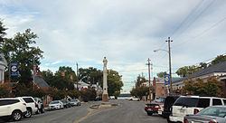
Tappahannock is the oldest town in Essex County, Virginia, United States. The population was 2,375 at the 2010 census, up from 2,068 at the 2000 census. Located on the Rappahannock River, Tappahannock is the county seat of Essex County. Its name comes from an Algonquian language word lappihanne (also noted as toppehannock), meaning "Town on the rise and fall of water" or "where the tide ebbs and flows." In 1608 John Smith landed in Tapphannock but was driven back by the local Native American tribe.
Contents
Map of Tappahannock, VA 22560, USA
History
In 1682 a local man, Jacob Hobbs, established a trading post in the now extinct Rappahannock County (in the vicinity of present-day Tappahannock). This area became known as "Hobbs Hole". The town comprised 50 acres (20 ha) divided into half-acre squares. The port was established at Hobbs Hole and called "New Plymouth", later changed back to the Indian name "Tappahannock". As part of the Tobacco Inspection Act of 1730 public warehouses for inspection and exportation of tobacco were established at Hobbs Hole.
The Tappahannock Historic District and Sabine Hall are listed on the National Register of Historic Places.
On February 24, 2016, the town was hit by a large EF3 tornado causing massive damage.
Geography
Tappahannock is located on the east side of Essex County at 37°55′20″N 76°51′47″W (37.922180, -76.863158), on the southwest bank of the Rappahannock River.
U.S. Routes 17 and 360 pass through the town. US 17 passes through the center of town as Church Lane, leading northwest 47 miles (76 km) to Fredericksburg and southeast 70 miles (110 km) to Newport News. US 360 runs through town with US 17 on Church Lane, but turns east on Queen Street and crosses the mile-wide Rappahannock, continuing east 39 miles (63 km) to its terminus in Reedville near the Chesapeake Bay. US 360 leads southwest from Tappahannock 45 miles (72 km) to Richmond, the state capital.
According to the United States Census Bureau, the town 2.7 square miles (6.9 km2), of which 2.6 square miles (6.7 km2) is land and 0.077 square miles (0.2 km2), or 2.84%, is water.
Demographics
As of the census of 2000, there were 2,068 people, 857 households, and 495 families residing in the town. The population density was 793.6 people per square mile (305.9/km²). There were 946 housing units at an average density of 363.0 per square mile (139.9/km²). The racial makeup of the town was 54.60% White, 41.60% African American, 0.10% Native American, 2.50% Asian, 0.10% from other races, and 1.00% from two or more races. Hispanic or Latino of any race were 0.40% of the population.
There were 857 households out of which 27.8% had children under the age of 18 living with them, 36.6% were married couples living together, 18.0% had a female householder with no husband present, and 42.2% were non-families. 35.8% of all households were made up of individuals and 14.4% had someone living alone who was 65 years of age or older. The average household size was 2.23 and the average family size was 2.91.
In the town, the population was spread out with 22.4% under the age of 18, 8.5% from 18 to 24, 27.0% from 25 to 44, 20.7% from 45 to 64, and 21.4% who were 65 years of age or older. The median age was 39 years. For every 100 females there were 78.1 males. For every 100 females age 18 and over, there were 73.6 males.
The median income for a household in the town was $33,688, and the median income for a family was $41,579. Males had a median income of $28,409 versus $20,431 for females. The per capita income for the town was $17,862. About 10.6% of families and 14.5% of the population were below the poverty line, including 26.6% of those under age 18 and 6.7% of those age 65 or over.