
Country Philippines Barangays ZIP code 3805 Population 8,529 (2010) Province Kalinga | District Lone District Time zone PST (UTC+8) Area 307.6 km² Local time Monday 12:51 AM | |
 | ||
Region Cordillera Administrative Region (CAR) Weather 20°C, Wind NE at 5 km/h, 100% Humidity Neighborhoods Awingan, Bogui, Taloctoc, Mantopngan, Lubo | ||
Tanudan is a fourth class municipality in the province of Kalinga, Philippines. According to the 2010 census, it has a population of 8,529 people.
Contents
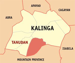
Map of Tanudan, Kalinga, Philippines
Barangays
Tanudan is politically subdivided into 16 barangays.
References
Tanudan, Kalinga Wikipedia(Text) CC BY-SA