
Area rank 10 of 105 Lowest elevation 190 m (620 ft) Area 41.72 km² Mayor Ali Kaes | Canton Vianden Highest elevation 537 m (1,762 ft) Time zone CET (UTC+1) Local time Sunday 12:29 PM Lau 2 04001 | |
 | ||
Weather 14°C, Wind E at 16 km/h, 43% Humidity | ||
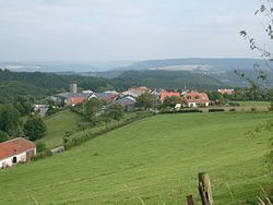
Tandel is a commune and village in eastern Luxembourg, in the canton of Vianden. It lies close to the border with Germany. As of 2001, the village of Tandel, which lies in the centre of the commune, has a population of 87. Other villages within the commune include Bastendorf, Bettel, Brandenbourg, Fouhren and Longsdorf.
Map of Tandel, Luxembourg
The commune of Tandel was formed on 1 January 2006 from the former communes of Bastendorf (in the canton of Diekirch) and Fouhren (in the canton of Vianden). The law creating Tandel was passed on 21 December 2004.
References
Tandel Wikipedia(Text) CC BY-SA