
Province Jakarta | ||
 | ||
Points of interest Jakarta History Museum, Wayang Museum, Museum of Fine Arts and Cera, Gereja Sion, Bank Mandiri Museum | ||
Taman Sari is a subdistrict of West Jakarta, Jakarta, Indonesia. It is the smallest subdistrict of West Jakarta (4.37 km2). Taman Sari is bounded by Central Jakarta to the south and to the east, and by North Jakarta to the north.
Contents
- Map of Tamansari West Jakarta City Jakarta Indonesia
- Taman Sari administrative village
- Glodok administrative village
- Kelurahan administrative villages
- List of important places
- Cited works
- References
Map of Tamansari, West Jakarta City, Jakarta, Indonesia
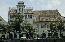
Taman Sari subdistrict contains the southeastern area of Jakarta Old Town, the area on the east side of Kali Besar Canal. This area is the oldest area of Jakarta and a center of administration of Batavia (the old name for Jakarta) during the 17th century. This historic area is located within the Pinangsia sdministrative village, the northern part of Taman Sari subdistrict.
Taman Sari administrative village
The area of Taman Sari, now located to the west of Mangga Besar Station, was first developed in 1913 by the Municipality of Batavia as one of the first attempt to systematically meet the demand for housing for the increasing local native population of Jakarta. The original core area of Taman Sari was near the intersection of Prinsenlaan (Jalan Mangga Besar) and Drossaersweg (Jalan Taman Sari Raya). The layout of the project was rectangular and divided into four blocks: one parallel to Jalan Mangga Besar, the other three parallel to Jalan Taman Sari Raya, the closest block along Jalan Taman Sari Raya undeveloped and intended for recreational use. Various housing types were allocated to the project: The northern part consisted of greatest variety of houses, from detached housing, to house with adjoining shop (warung); the southern part has a slightly narrower and shallower plot with smaller house types. The larger northern area had an en suite bathroom and toilet for each property, while the southern area had communal sanitary facility.
Despite its central location, the project proved to be a failure. Native population did not want to settle in Taman Sari because of the Western-centric house layout. In 1918, five years after it was implemented, the city council of Batavia decided to demolish the project. The project became a learning process for kampong-improvement projects in the Indies that requirement of the locals cannot be blindly designed with a Dutch model.
Glodok administrative village
Glodok administrative village, on the eastern part of Taman Sari, is the largest Chinatown in Jakarta.
Kelurahan (administrative villages)
The subdistrict of Taman Sari is divided into eight kelurahan or administrative villages: