
Country United States Time zone ChST (UTC+10) Local time Sunday 11:50 AM | Territory Guam Area 45.81 km² Population 3,050 (2010) | |
 | ||
Weather 29°C, Wind E at 24 km/h, 74% Humidity | ||
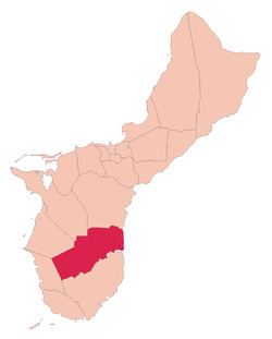
Talofofo (Chamorro: Talo fo' fo') is a village located in the southern part of the United States territory of Guam, on the east coast. The village center is located in the hills above the coast, while the smaller coastal community below the cliff is known as Ipan.
Contents
Map of Talofofo, Guam
The village contains two golf courses. Other tourist attractions include Jeff's Pirate's Cove Restaurant and Museum, Talofofo Caves, Talofofo Falls Resort Park, Ipan Beach Resort and a Talofofo River boat cruise to an ancient Chamorro village. Japanese holdout from World War II Shoichi Yokoi was discovered by Jesus Duenas and Manuel DeGracia near Talofofo on January 24, 1972 A recreation of his hide out cave is included at the Talofofo Falls Resort Park.
The village is located south of Yona and north of Inarajan.
Education
Guam Public School System serves the island.
Talofofo Elementary School serves elementary school students. Southern High School in Santa Rita serves the village.
Notre Dame High School, a Catholic high school, is in Talofofo.