
Prefecture Kanagawa Established April 1, 1972 Local time Saturday 11:05 PM | Region Kantō Population 215,158 (Mar 2010) | |
 | ||
Weather 6°C, Wind N at 18 km/h, 75% Humidity Colleges and Universities Senzoku Gakuen, Senzoku Junior College o, Shin‑Maruko School | ||
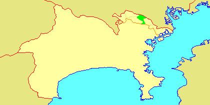
Takatsu-ku (高津区) is one of the 7 wards of the city of Kawasaki in Kanagawa Prefecture, Japan. As of 2010, the ward had an estimated population of 215,158 and a density of 13,150 persons per km². The total area is 16.38 km².
Contents
- Map of Takatsu Ward Kawasaki Kanagawa Prefecture Japan
- illuminations at mizonokuchi takatsu ku kawasaki city kanagawa prefecture japan
- Geography
- Surrounding municipalities
- Neighborhoods
- History
- Economy
- Railway
- Highway
- Education
- Shrines and temples
- Noted people from Takatsu Ward
- References
Map of Takatsu Ward, Kawasaki, Kanagawa Prefecture, Japan
illuminations at mizonokuchi takatsu ku kawasaki city kanagawa prefecture japan
Geography
Takatsu Ward is located in eastern Kanagawa Prefecture, in the north-center portion of the city of Kawasaki, bordering on Tokyo. It is bordered to the north by the Tama River.
Surrounding municipalities
Neighborhoods
Mizonokuchi, Futago, Seta, Suwa, Kitamigata, Shimonoge, Hisamoto, Sakado, Kuji, Unane, Shimo-Sakunobe, Kami-Sakunobe, Mukaigaoka, Suenaga, Kajigaya, Shinsaku, Chitose, Chitose-Shin-cho, Shibokuchi, Shibokuchi-Fujimi-dai, Hisasue, Kanigaya, Akutsu, and Nogawa.
History
Archaeologists have found stone tools from the Japanese Paleolithic period and ceramic shards from the Jomon period at numerous locations in the area. Under the Nara period Ritsuryō system, it became part of Tachibana District Musashi Province. By the Heian period it was part of a shōen coming under control the Late Hōjō clan from Odawara in the late Muromachi period. In the Edo period, it was administered as tenryō territory controlled directly by the Tokugawa shogunate, but administered through various hatamoto. After the Meiji Restoration, the area was divided into eight villages within Tachibana District in the new Kanagawa Prefecture on April 1, 1889. These areas were annexed by the neighboring city of Kawasaki from 1937-1938. The area became part of a huge government sponsored housing project from the 1950s and 1960s. The area became part of Tama Ward with the division of the city of Kawasaki into wards from April 1972. In July 1982, Miyamae Ward was separated from Takatsu Ward.
Economy
Takatsu Ward is largely a regional commercial center and bedroom community for central Kawasaki and Tokyo. Industries are centered on food processing, electronics and precision equipment, and include:
Railway
Highway
Education
There is a North Korean school, Nambu Korean Primary School (南武朝鮮初級学校).