
Local time Saturday 2:47 PM | ||
 | ||
Weather 20°C, Wind NW at 8 km/h, 56% Humidity | ||
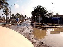
Taji (Arabic: التاجي) is a rural district north of the city of Baghdad, within Baghdad Province and Saladin Province.
Contents
Map of Taji, Iraq
Taji District has about 400,000 inhabitants.
History
Al-Taji airfield, in the volatile Sunni Triangle, was originally an Iraqi Republican Guard base during the Saddam era. It was once a center for the manufacture of chemical weapons. Taji was also the location of the largest tank maintenance facility in Iraq.
Its religious make-up is changing, due to persecution and forced displacement of Sunni Arab natives and arrival of Shia Arabs favored by the new government in Baghdad.
Cities
References
Taji, Iraq Wikipedia(Text) CC BY-SA