
Country United States County El Dorado County Local time Friday 11:27 PM | State California Elevation 1,902 m | |
 | ||
Weather 2°C, Wind NE at 2 km/h, 93% Humidity | ||
Tahoe Keys, now incorporated within South Lake Tahoe, is a former unincorporated community in El Dorado County, California It lies at an elevation of 6,240 feet (1,900 m).
Contents
Map of Tahoe Keys, South Lake Tahoe, CA 96150, USA
Ongoing Environmental damage
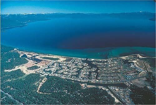
Built in the 1960s, the community consists of over 1,500 homes adjacent to a series of canals. Its construction destroyed half of the Upper Truckee Marsh, the primary filter for river water entering the lake, and has since been called the most environmentally damaging intrusion on the lakeshore in Lake Tahoe's human history.
The Tahoe Keys due to lack of maintenance and poor planning have the largest population of Non native plants and fish in Lake Tahoe. In recent years the weeds in the Tahoe Keys have gotten worst and they are now proposing the use of herbicides in Lake Tahoe to stop them.