
Population 330 (2011 census) Postal code 3714 | Postcode(s) 3714 Local time Saturday 4:09 PM | |
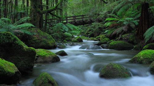 | ||
Location 108 km (67 mi) NE of Melbourne52 km (32 mi) NE of Kinglake18 km (11 mi) S of Alexandra Weather 24°C, Wind N at 11 km/h, 58% Humidity Points of interest Cathedral Range State Park, Cathedral Range, Neds Peak, Little River | ||
Taggerty is a town in central Victoria, Australia. It is located at the intersection of Maroondah Highway and Thornton Road. The Acheron River also crosses the highway at Taggerty. At the 2011 census, Taggerty and the surrounding area had a population of 330.
Map of Taggerty VIC 3714, Australia
A pastoral run called Taggerty Run was established in 1846. The homestead of the run was called Taggerty House. Gold was discovered along the Acheron River in 1870, which led to the establishment of two settlements, named Acheron Lower (now known as Acheron) and Acheron Upper (now known as Taggerty). The Post Office opened on April 15, 1876 and was renamed Taggerty in 1893. Acheron Upper Primary School opened in 1875. The general store opened in 1891, as did a butter factory, reflecting the area's shift from gold mining towards dairy farming. The town was given the name Taggerty in 1890 to avoid confusion with Acheron Lower.
Today Taggerty remains a small township, with a general store, primary school, a town hall, a caravan park, and several bed and breakfasts.