
Country Philippines Barangays ZIP code 6719 Local time Saturday 12:48 PM | District 1st district of Samar Time zone PST (UTC+8) Area 28.7 km² Province Samar | |
 | ||
Region Eastern Visayas (Region VIII) Weather 29°C, Wind N at 13 km/h, 68% Humidity | ||
Tagapul-an is a 5th class municipality in the province of Samar, Philippines. According to the 2015 census, it has a population of 8,473 people.
Contents
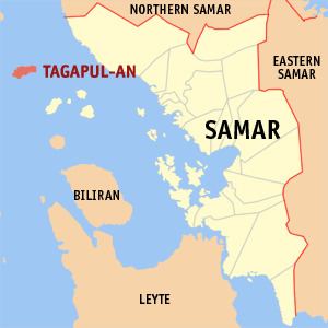
Map of Tagapul-an, Samar, Philippines
It is the farthest municipality from the province's mainland.
Barangays
Tagapul-an is politically subdivided into 14 barangays.
References
Tagapul-an, Samar Wikipedia(Text) CC BY-SA