
Country United States Area code(s) 715 & 534 Elevation 370 m Population 361 (2000) | Time zone Central (CST) (UTC-6) FIPS code 55-78950 Local time Friday 11:19 PM | |
 | ||
Weather 3°C, Wind NE at 13 km/h, 86% Humidity Area 94.79 km² (94.53 km² Land / 26 ha Water) | ||
Taft is a town in the southwest corner of Taylor County, Wisconsin, United States. The population was 361 at the 2000 census. The unincorporated community of Bellinger is located partially in the town.
Contents
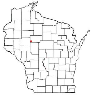
Map of Taft, WI, USA
Geography
According to the United States Census Bureau, the town has a total area of 36.6 square miles (94.8 km²), of which, 36.5 square miles (94.5 km²) of it is land and 0.1 square miles (0.3 km²) of it (0.35%) is water.
History
In July 1847 a crew working for the U.S. government surveyed the boundaries of the six mile square which would become Taft. This was repeated in late 1848. Then in June 1854 another crew marked all the section corners in the township, walking through the woods and swamps, measuring with chain and compass. When done, the deputy surveyor filed this general description:
The Surface of this Township is generally Broken Soil 3rd rate producing but little vegetation the Surface of the land being generally covered with a thick heavy moss(?). There are numerous Swamp in the Township Some of which are of considerable extent. The Timber in the Swamps is principally Tamarac. The dry land is timbered mostly with Hemlock. There are Some Scattering groves of White Pine though of poor quality and not valuable for lumber. The Township is well watered with numerous Small Streams which rise in the Swamps. There are no Settlers in the Township.
Demographics
As of the census of 2000, there were 361 people, 120 households, and 84 families residing in the town. The population density was 9.9 people per square mile (3.8/km²). There were 132 housing units at an average density of 3.6 per square mile (1.4/km²). The racial makeup of the town was 97.51% White, 0.55% Native American, 0.28% Asian, 1.11% from other races, and 0.55% from two or more races. Hispanic or Latino of any race were 1.39% of the population.
There were 120 households out of which 40.8% had children under the age of 18 living with them, 64.2% were married couples living together, 2.5% had a female householder with no husband present, and 29.2% were non-families. 20.8% of all households were made up of individuals and 10.8% had someone living alone who was 65 years of age or older. The average household size was 3.01 and the average family size was 3.64.
In the town, the population was spread out with 34.3% under the age of 18, 8.0% from 18 to 24, 25.5% from 25 to 44, 17.2% from 45 to 64, and 15.0% who were 65 years of age or older. The median age was 37 years. For every 100 females there were 109.9 males. For every 100 females age 18 and over, there were 119.4 males.
The median income for a household in the town was $37,500, and the median income for a family was $41,071. Males had a median income of $24,615 versus $21,429 for females. The per capita income for the town was $14,447. About 5.6% of families and 8.7% of the population were below the poverty line, including 10.4% of those under age 18 and 13.3% of those age 65 or over.