
Area 18.03 km² Local time Tuesday 7:28 AM | Population 42,695 (May 2015) | |
 | ||
Region Chūbu regionTōkai region Weather 7°C, Wind NW at 18 km/h, 69% Humidity | ||
Tōgō (東郷町, Tōgō-chō) is a town located in Aichi District, Aichi Prefecture, Japan.
Contents
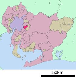
- Map of Togo Aichi District Aichi Prefecture Japan
- Geography
- Neighboring municipalities
- History
- Education
- Railway
- Highway
- Local attractions
- References
Map of Togo, Aichi District, Aichi Prefecture, Japan
As of May 2015, the town had an estimated population of 42,695 and a population density of 2370 persons per km². The total area was 18.03 square kilometres (6.96 sq mi).
Geography
Tōgō is located in the flatlands of central Aichi Prefecture.
Neighboring municipalities
History
Tōgō Village was established in 1878 through the merger of several small hamlets. It was elevated to town status on April 1, 1970.
Education
Railway
Tōgō currently has no passenger train station within town limits.
Highway
Local attractions
References
Tōgō, Aichi Wikipedia(Text) CC BY-SA