
- summer (DST) CEST (UTC+2) Area 21.34 km² | Elevation 281 m Local time Monday 11:59 PM | |
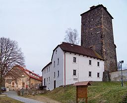 | ||
Weather 7°C, Wind SE at 3 km/h, 59% Humidity Points of interest Zbořený Kostelec, Hrad Týnec Nad Sázavou, Muzeum týnecké keramiky, Čížov | ||
Týnec nad Sázavou is a town in the Czech Republic. It is located 30 kilometres (19 mi) south of Prague on Sázava river.
Map of T%C3%BDnec nad S%C3%A1zavou, Czechia
The municipality covers an area of 21.34 square kilometres (8.24 sq mi) and as of 2012 it had a population of 5599. First written notice about the village is from year 1318.
The villages of Brodce, Čakovice, Chrást nad Sázavou, Krusičany, Pecerady, Podělusy and Zbořený Kostelec are administrative parts of Týnec nad Sázavou.
References
Týnec nad Sázavou Wikipedia(Text) CC BY-SA