
Time zone GMT +5 (UTC+5) Population 58,786 (2009) | Area 2,121 km² | |
 | ||
Weather 6°C, Wind N at 11 km/h, 61% Humidity | ||
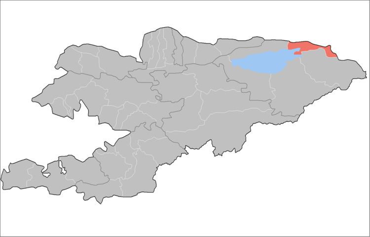
Tüp is a raion (district) of Issyk-Kul Region in north-eastern Kyrgyzstan. The capital lies at Tyup. Its area is 2,121 square kilometres (819 sq mi), and its resident population was 58,786 in 2009. It borders Issyk Kul District to the west, Ak-Suu District to the east and south-east, Kazakhstan to the north, and Issyk Kul to the south.
Populated places
In total, Tüp District includes 14 rural communities (aiyl okmotus). Each rural community may include one or several villages. The rural communities and villages in the Tüp District are:
- Ak-Bulak rural community (village Ak-Bulak)
- Aral aiyl okmotu (center - village Ming-Bulak and also villages Aral, Dolon, Kosh-Debe, Sary-Döbö)
- Issyk-Kel aiyl okmotu (center - village Issyk-Kel, and also village Yntymak)
- Kuturgu aiyl okmotu (center - village Kuturgu, and also villages Kichi-Örüktü, Oy-Bulak, Oy-Tal)
- Mikhaylovka aiyl okmotu (center - village Mikhaylovka)
- Toguz-Bulak aiyl okmotu (villages Toguz-Bulak, Sary-Bulun)
- San-Tash aiyl okmotu (center - village Bayzak, and also villages Karkyra, Keng-Suu, San-Tash, Sary-Tölögöy)
- Sary-Bulak aiyl okmotu (center - village Balbay, and also village Kürmöntü)
- Ak-Bulun aiyl okmotu (center - village Ak-Bulun, and also villages Belovodskoe, Frunzenskoe)
- Taldy-Suu aiyl okmotu (center - village Taldy-Suu, and also villages Ichke-Suu, Keochu, Korumdu)
- Karasaev aiyl okmotu (center - village Tasma, and also villages Toktoyan, Chong-Toguz-Bay)
- Tüp aiyl okmotu (center - village Tüp, and also villages Birlik, Shaty)
- Chong-Tash aiyl okmotu (center - village Chong-Tash and also village Jyluu-Bulak)
References
Tüp District Wikipedia(Text) CC BY-SA