
Country Brazil Elevation 762 m (2,500 ft) Postal Code 09600-000 Area 407.1 km² | Region Southeast Time zone BRT (UTC-3) Area code(s) +55 11 Population 736,466 (2010) | |
 | ||
Weather 19°C, Wind SE at 11 km/h, 82% Humidity Colleges and Universities Methodist University of São Pa, Faculty of Law of São Bernardo, Industrial Engineering Faculty, São Paulo State Technolo | ||
São Bernardo do Campo ([sɐ̃w beʁˈnaʁdu du ˈkãpu]) is a municipality in the state of São Paulo. It is part of the Metropolitan Region of São Paulo. The population is 816,925 (2015 est.) in an area of 409.51 km².
Contents
- Map of SC3A3o Bernardo do Campo State of SC3A3o Paulo Brazil
- Amador te arrancare de mi
- History
- Geography
- Climate
- Demographics
- Ethnic groups
- Economy
- Colleges and universities
- Roads
- Public transportation
- Today
- Twin towns Sister cities
- References
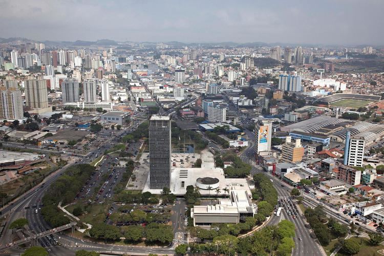
Map of S%C3%A3o Bernardo do Campo, State of S%C3%A3o Paulo, Brazil
Amador te arrancare de mi
History
The city was founded by João Ramalho in 1553 and was known as Vila de Santo André da Borda do Campo de Piratininga, soon transferred to another nearby place, safer from hostile tribes. It is, however, historically perceived as the first Brazilian settlement built away from the sea. The original settlement was then resettled as São Bernardo, became a parish in 1812 and became a municipality in 1890. In 1938, it became a part of the Santo André district only to be separated again in 1945, as the aftermath of an action from a group of entrepreneurs led by Wallace Cochrane Simonsen, who was eventually appointed as the first mayor of the newborn municipality.
The area where São Bernardo do Campo, Santo André, São Caetano do Sul, and Diadema are located was once a farm owned by Benedictine monks, who owned enslaved Africans. By the second half of the 19th century, European immigrants started to come to the area, mainly from Italy. Italians settled in cottages in the rural area of São Bernardo do Campo that were called colônias. By the beginning of the 20th century, Japanese immigrants arrived, most of them going to the neighborhood called Cooperativa.
Industry, particularly metal works, thrived in the city during the 1960s, when São Bernardo do Campo became known as Brazil's Automobile Capital (Portuguese: a Capital do Automóvel). Many of these plants have since relocated to other regions but the automobile industry remains a vital part of the history of São Bernardo do Campo. The city is also known for its furniture industry developed by Italian immigrants, who helped São Bernardo do Campo become a high-tech industrial pole.
Industrialization also attracted migrants from the Brazilian Northeastern region in the 1960s. Among them was the family of Luiz Inácio Lula da Silva, who grew up in the region. The former president of Brazil worked in automobile factories in São Bernardo do Campo in the 1970s, having become a union and anti-military dictatorship figure, albeit controversial, before being elected president of the republic.
São Bernardo also contributed to the development of Brazilian cinema, mainly during the 1950s and 1960s, thanks to the Vera Cruz studios, which produced a great number of movies and revealed many notable actors. This is also the birthplace of the football player Anderson Luís de Souza, better known as Deco.
Geography
São Bernrdo do Campo locates itself in the top of the Serra do Mar, on the Atlantic plateau, occupies an area of 407,1 square kilometres, and the altitude varies between 60 meters of the level of the sea, in the juncture of Rio Passareúva with the Pilões river, at the foot of the mountain range, to 986.5 meters, in the peak of the Bonilha, in the neighborhood Montanhão.
Climate
According to the Köppen climate classification São Bernardo do Campo has a humid subtropical climate. On average of the maximum temperatures is of 24.0 Celsius, on average of the minimums is of 14.8 and on average is of 19.09 Celsius. In 2010 the summer temperatures reached 34 to 35 °C (93 to 95 °F) in January–February. Also in summer, normally in a few days heavy storms occur, reaching 110 mm (4 in) of precipitation. Winter is the coldest of the ABC region. Some days in July and August, the temperatures reaches 8 °C (46 °F) or less, but towards the end of winter the heat begins again with temperatures reaching 23 to 27 °C (73 to 81 °F). Summer 2012, was not as hot as the previous 5 years. Also the average temperature average has decreased over the years 27.2 °C (81.0 °F) (2011), 23.7 °C (74.7 °F) (2012).
Demographics
As of the census of 2006, the population was 803,906, making it the second most populous suburb of São Paulo, and fourth most populous city in the state. The population density was 1,937.02/km2.
Source: PNAD.
Ethnic groups
The population are primarily Afro- and Luso-Brazilians. There are significant populations of Italian, Arab, Asian (mostly Japanese) Spanish and German descendents.
Economy
São Bernardo do Campo, from the 1950s had its economy based on the auto industry - At that time, the Brazilian Federal Government headed by Juscelino Kubitschek decided to create an executive board to promote local carmaking - the Grupo Executivo da Indústria Automobilística (GEIA) (Executive Group for Automobile Industry). Providing, among other regulations, a minimum amount of national components to integrate the vehicles, it stimulated the implantation of carmakers and auto parts industries.
At that time, the German companies Volkswagen, Karmann-Ghia and Mercedes-Benz, as well the American Willys-Overland started to build their factories in São Bernardo do Campo, later followed by Simca, Toyota and Scania.
In 1967, Willys-Overland has been bought by Ford Motor Co. In that same year, the French carmaker Simca became a Chrysler plant, ending its operations in 1981 when it was acquired from Volkswagen to be their truck division. This plant has been shut down definitely in 1990 and gave place in 2006 to a warehouse from one of the biggest retail stores in Brazil, Casas Bahia.
Together with those first automakers in Brazil, other factories established themselves in the city, e.g. paint industries as BASF, which produces Suvinil brand paintings, and auto parts industries that support them, as well the largest industrial plant in the world of Colgate-Palmolive toothpaste.
In the 1990s, the economy of the region had a wide variation, which increased the importance of the service sector in the city. The trade is diverse and found in every neighborhood, especially the traditional trade Marshal Deodoro Street and environs, and the nationally known Center Furniture at Jurubatuba street, which gives São Bernardo do Campo the name of Furniture Capital. The construction and urban reform was boosted in 2008 with the construction of the southern section of the Rodoanel Mário Covas beltway, a ring road in the Metropolitan Region of São Paulo, Avenida Pery Ronchetti with duplication and channeling Saracantan stream, plus the construction of many buildings, mostly residential, with reforms of the Metropolis Mall and the Golden Shopping Mall.
As of 2014, São Bernardo do Campo exports $3.59B (USD) worth of goods and represents 1.48% of Brazil's total exports. Transportation manufacturing and machine manufacturing make up the majority (84%) of the municipality's exports. The top five material goods exported by São Bernardo do Campo are Delivery Trucks (14%), Tractors (14%), Vehicle Chassis (13%), Cars (13%), and Vehicle Parts (12%).
Colleges and universities
Roads
Public transportation
Local bus service is provided by SBCTrans - Consórcio São Bernardo Transportes, which has owned the rights to operate the ETCSBC - Empresa de Transporte Coletivo de São Bernardo do Campo routes in 1998. Buses and minibuses are used in this operation. Intercity buses are also available connecting São Bernardo do Campo to Diadema, Mauá, Osasco, Ribeirão Pires, Rio Grande da Serra, Santo André, São Caetano do Sul and São Paulo. Many bus companies operate such routes under permission of EMTU - Empresa Metropolitana de Transportes Urbanos de São Paulo, a state-owned company.
EMTU is also responsible for the Corredor São Mateus-Jabaquara bus system, connecting Diadema, Santo André, Mauá and South and East regions of São Paulo. It is operated by METRA - Sistema Metropolitano de Transportes. As it uses a busway in most of its path, it is considered a bus Rapid Transit system. It also provides access to Line 1 of São Paulo Metro thru Jabaquara terminal, the Jabaquara Bus Terminal and Line 10 of the commuter rail CPTM in Santo André station. This bus system is often called as trolleybus system as it employs many trolley buses. This system is considered part of the Metropolitan Transport Network of São Paulo.
The integration among local bus service, intercity buses and trolleybus system can be done at Ferrazópolis Bus Terminal and São Bernardo Bus Terminal. The latter is located beside Terminal Rodoviário João Setti, a bus terminal which also provides long-distance and interstate bus routes, giving access to the coast and countryside of São Paulo, Santa Catarina, Paraná, Rio de Janeiro, Minas Gerais, Bahia, Ceará, Paraíba, Mato Grosso and Rondônia states, as well as the Brazilian capital Brasília.
Today
The city is a core part of the ABC region (A = Santo André, B = São Bernardo do Campo, C = São Caetano do Sul).
Public transportation in São Bernardo do Campo is provided by ETCSBC (Empresa de Transporte Coletivo de São Bernardo do Campo) and EMTU (Empresa Metropolitana de Transportes Urbanos, "Metropolitan Urban Transport Company").
The city is known for important private universities such as the Universidade Metodista de São Paulo and Centro Universitário da FEI.
SBC is also known because of the number of small Newspapers that the city has, for example: Jornal da Balsa, Jornal Hoje, Tribuna do ABCD, and more.
There is the Diário do Grande ABC a daily news about all region, the paper is located in Santo André, but it is distributed in all ABC and some parts of São Paulo.
Twin towns – Sister cities
São Bernardo do Campo is twinned with: