
Country United States ZIP codes 73666 Elevation 662 m Population 92 (2013) | Time zone Central (CST) (UTC-6) FIPS code 40-71900 Zip code 73666 Local time Sunday 5:26 AM | |
 | ||
Weather 8°C, Wind N at 18 km/h, 90% Humidity Area 41.1 km² (41.05 km² Land / 5 ha Water) | ||
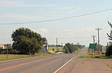
Sweetwater is a town in Beckham and Roger Mills counties in the U.S. state of Oklahoma. It was incorporated in 2003. As of the 2010 census it had a population of 87.
Contents
Map of Sweetwater, OK 73666, USA
Named for nearby Sweetwater Creek, the town is at the junction of State Highway 30 and State Highway 152. The post office (zip code 73666), was established September 27, 1894.
On May 5, 2007, a tornado, rated on the Enhanced Fujita Scale (EF scale) as EF3, traveled on a path around 100 to 150 yards (91 to 137 m) wide and 7.5 miles (12.1 km) long. It began about 2.5 miles (4.0 km) south of Sweetwater and ended approximately 5 miles (8 km) north of Sweetwater, following State Highway 30. EF3 wind speeds range from 136 to 165 miles per hour (219 to 266 km/h). It severely damaged several buildings in the town, including the church and high school, and destroyed eight homes.
Education
The Sweetwater Public School District is one of the smallest public school districts in the state of Oklahoma. For the most recent data available, it tied with Boley for the smallest high school with 15 students. For a combined district, K-12, Sweetwater finished third behind Boley (51) and Clarita (58), with 60 students.