
Population 17,327 (Jan 2011) Local time Sunday 4:31 AM | Area 247.2 km² | |
 | ||
City hall address 1-6-2, Uedomachi Kitagata, Suzu-shi, Ishikawa-ken927–1295 Website www.city.suzu.ishikawa.jp Weather 0°C, Wind NE at 6 km/h, 64% Humidity | ||
Suzu (珠洲市, Suzu-shi) is a city located at the northeastern-most tip of the Noto Peninsula in Ishikawa Prefecture, Japan. The city was founded on 15 July 1954 out of the merger of many smaller towns in the vicinity.
Contents
- Map of Suzu Ishikawa Prefecture Japan
- Historical overview
- Location and geographical features
- Climate
- Demographics
- Industries
- Mayor
- Newspapers
- Cable television
- Famous places
- Festivals
- Etymology of Suzu
- Sister city
- References
Map of Suzu, Ishikawa Prefecture, Japan
As of 2011, the city has an estimated population of 17,327 and a population density of 70.1 persons per km2. The total area is 247.20 km2.
Historical overview
In ancient times, Suzu prospered as a gateway for trade by sea, establishing connections with places such as Izumo (Shimane Prefecture), Sado (Sado Island) and Ezo (Hokkaido). In turn, Suzu was introduced to ironware culture from a considerably early period in the Izumo era, and even gained crucial agricultural influence and knowledge for civilians to start farming within Suzu. In fact, it is thought that such ancient Noto culture originated and spread outwards from the tip of the Noto peninsula.
In the second year of the Yourou Era (718), the Province of Noto was segregated and established the 4 districts of Suzu, Fugeshi, Hakui and Noto. For a short period of time, the land was claimed as part of Etchu Province (Toyama Prefecture). During this period the famous Otomo no Yakamochi (Etchu Provincial Governor at the time) recited a poem about the picturesque scenery of Suzu bay upon visiting Suzu, which would later be enlisted in the famous poetry anthology called the Manyoshu.
Later in the Kouji Period (1143), the Noto Provincial Governor Minamoto no Toshikane established "Wakayama Manor" on private land. Before long, Minamoto had developed the "Wakayama Manor" into the biggest Manor in all of Noto, expanding territory to take over the majority of land in Suzu. In similar times, production of "Suzu-Yaki" (Suzu brand Pottery) had begun, with oversea distribution to Hokkaido becoming common. Suzu developed into one of the very few areas in Japan named famous for producing pottery.
During the Warring States Period (1467–1568), the ongoing violent fighting between the Hatakeyama family, Uesugi family and the Maeda family tore the land part. However, pressure from the Maeda Family Army eventually took told, and the Uuesugi Family Army fell, conceding all of the land to the Maeda Family who were part of the Kaga Clan.
Since ancient times in Noto, salt making using earthenware had been prospering by utilizing the geographical advantage of its long peninsula coastline. However, the method used to make salt changed over the years, and people took to drying salt by the beaches. Before long, the Suzu coastline became filled with salt farms, and this "beach drying" technique became branded as a National cultural importance by Japan.
When the Clan system was abolished in Japan in 1871, administrative districts were split and revised over and over again, until the territorial borders of Suzu were eventually settled as 1 town and 14 villages in 1889. Years later in 1954, all of the administrative districts were merged to become the city we know today.
Later, the city became the proposed site of the Suzu Nuclear Power Plant; however, in 2003 the proposal was "frozen" until further notice.
At 9:42 am on the morning of 25 March 2007, the Noto earthquake occurred. The earthquake was reported as a strong 5 on the Shindo intensity scale in Shouin-machi, a weak 5 in Ootani-machi, and a 4 in Misaki-machi.
On 4 April 2009, the city participated in the "Rehearsal for Ending Analog Broadcasting" organized by the Ministry of Internal Affairs and Communications. Later, on 24 September 2010, all analog broadcasting in the area was stopped completely.
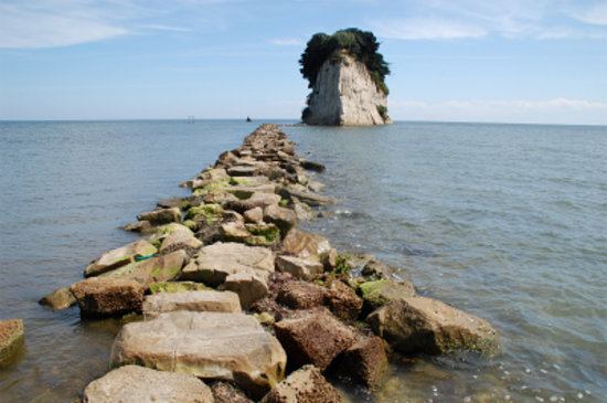
Location and geographical features
Located almost in the middle of Japan and at the top of the Noto Peninsula, Suzu is surrounded by the ocean in three directions. It shares borders with the City of Wajima, and with the Town of Noto of the Hōsu district to the west. Suzu is surrounded by nature, with thick forestry areas and miles of beautiful coastline. Many local traditions have been preserved over the years, lending it a rich culture one can see even today. Within the City grounds, diatomaceous soil can be found almost anywhere, and has been used to produce portable clay stoves ever since the Edo period.
Climate
Suzu has a humid subtropical climate (Cfa, according to the Köppen climate classification). Precipitation is abundant throughout the year, with an annual average of 2,245 millimetres (88.4 in). Summers are warm to hot and winters are chilly, with snowfalls.
Demographics
Of all the cities on Honshu, Suzu's has the smallest population.
Industries
More recently, Suzu has become known for its production of specialized charcoal for the Japanese tea ceremony.
Mayor
Newspapers
Cable television
Famous places
Festivals
Etymology of Suzu
The City of Suzu is thought to have been named after Suzu Shinto Shrine, which is located in Awazu. The name Suzu is mentioned in the National Record Book of Japan, though the Kanji for Suzu (珠洲) is not thought to have been identified until the early Wadou era (Year 713).
There is also the theory that the name originates from the Ainu language, as several other place names in the area are said to come from that language.