
Local time Friday 1:42 PM | ||
 | ||
Weather 14°C, Wind SW at 40 km/h, 59% Humidity | ||
Sunderland Bridge is both a bridge and a village in County Durham, England, about 3 miles (4.8 km) south of Durham City. Both lie close to the confluence of the River Wear and River Browney.
Contents
Map of Sunderland Bridge, Durham, UK
The village
The village forms part of the civil parish of Croxdale and Hett, within the unitary district of County Durham. Local government responsibilities are shared between parish and district councils.
The bridge
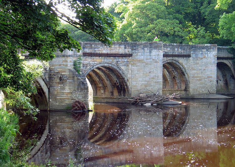
Sunderland Bridge originally carried the Great North Road (A1) across the River Wear, and probably dates back to the 14th century. It is built of dressed sandstone with four semicircular arches. The bridge has undergone several rebuilds, with the end arches being rebuilt in 1770, the parapets widened in 1822, and new end walls built in the 19th century. It is a grade I listed structure.
When a new bridge was needed as the existing bridge was not wide enough to cope with traffic, Croxdale Bridge was constructed to the east of the existing bridge. The A1 at this point was later re-designated as the A167, and Croxdale Bridge continues to carry this road.
Sunderland Bridge now carries local traffic across the river. The bridge straddles the parishes of Brandon and Byshottles and Croxdale and Hett.