Prominence 10m (33ft) Topo map OS Landranger 150 Elevation 368 m Age of rock Precambrian | Mountain type Igneous, Metamorphic Easiest route Hiking | |
 | ||
Similar Table Hill, North Hill - Malvern, Jubilee Hill, Pinnacle Hill, Worcestershire Beacon | ||
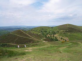
Sugarloaf Hill lies between the Worcestershire Beacon and North Hill in the range of Malvern Hills that runs about 13 kilometres (8 mi) north-south along the Herefordshire-Worcestershire border.
Map of Sugarloaf Hill, Malvern, UK
The summit of Sugarloaf Hill is 368 metres (1,207 ft) above sea level and is a popular peak usually passed by walkers hiking between the Worcestershire Beacon and North Hill—respectively the highest and second highest Malvern Hills summits.
References
Sugarloaf Hill, Malvern Wikipedia(Text) CC BY-SA
