
Population 3,468 (2011 census) Postal code 2481 | Postcode(s) 2481 Local time Friday 4:38 AM | |
 | ||
Weather 22°C, Wind S at 43 km/h, 92% Humidity | ||
Suffolk Park is a suburb in the Byron Shire of the Northern Rivers region in New South Wales, Australia. It is five km south of Byron Bay. Its population according to the 2011 Census was 3,468.
Contents
Map of Suffolk Park NSW 2481, Australia
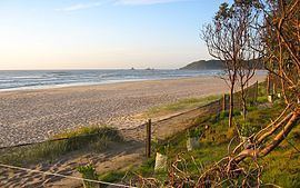
The town was named after George A. Suffolk (1876-1952) who dedicated a large parcel of land to the Byron Shire Council for community use on 16 November 1922. Suffolk Park has grown to a point of having its own identity. Situated just south of Cape Byron, Suffolk Park is a ten-minute drive from Byron Bay. Tallow Beach, which stretches 15 km from Cosy Corner at the Cape south to Broken Head lies adjacent to the suburb.
Streets
The main shops are located on Clifford Street. The beach runs parallel with Alcorn Street. Other notable streets are Armstrong Street and Brandon Street. Some residents of Alcorn Street were accused of appropriating Suffolk Park beach reserve into their backyards in 2008. Native vegetation had been removed, private tracks to the beach and misleading signs had resulted in degradation of the coastal foreshore.
Landmarks
Notable landmarks in the area are "Cocked-Hat Rocks", (a large rocky outcrop at the Broken Head beach) which are also known by traditional Bundjalung people as "Sister's Rocks", the Suffolk Park Caravan Park, and King's Beach.
Facilities
There is a small shopping centre at the corner of Clifford Street and Broken Head Road that services Suffolk Park with a post office, liquor store, pub, newsagent, bakery, pharmacy, movie rental, and a few restaurants and take-aways. Suffolk Park also features a small recreational area behind the fire station, Gaggin Park, through which entry to Tallow Beach is available.
Sporting clubs
Suffolk Park Phoenix Football Club was formed in 2012. It is the first officially recognized sporting team for Suffolk Park. The home ground is in Beech Drive. In 2013, Suffolk Park FC won its first trophies as the Men's 3rd Division side won the pointscore (minor premiership) as well as winning the grand final. In 2014 the Men's 2nd Division won the pointscore competition although lost the Grand Final on penalties. 2015 has been the club's most successful season yet with all of the club's senior teams making the Grand Final. The Men's 5th Division being both pointscore and Grand Final champions, defeating Dunoon 4-1 in the Grand Final. The Men's 1st Division team came from 3rd on the table to defeat Italo Stars in a penalty shootout after going through extra time at 0-0. The Women's 4th Division unfortunately lost their Grand Final 3-0 to neighbours Byron Bay. The club also had 3 junior miniroo teams in 2015 with a 6 years, a 7 years and an 11 years team. They all enjoyed a season full of fun and football.
Suburbs
The geographic/political locality of Suffolk Park extends north to Byron Bay; west to encompass Baywood Chase and Byron Hills; and south to Broken Head however Baywood Chase and Byron Hills are often considered separate suburbs because of their considerable sizes. Baywood Chase and Byron Hills were planned construction and feature many cul de sacs, which are favourite settling spots for many young families with children.