
- summer (DST) CEST (UTC+2) Local time Thursday 3:54 AM | Area 67.18 km² | |
 | ||
Weather 9°C, Wind W at 6 km/h, 71% Humidity | ||
Stupava (German: Stampfen; Hungarian: Stomfa) is a town in western Slovakia. It is situated in the Malacky District, Bratislava Region.
Contents
Map of 900 31 Stupava, Slovakia
Etymology
The name is derived from Proto-Slavic stǫpa (Slovak: stupa) - a wooden bowl carved from a tree trunk, but also the name of various crushing and pressing tools.
Geography
The town is located in the Záhorie lowland, under the Little Carpathians, around 15 km (9 mi) north of Bratislava at an altitude of 182 metres. It has 13, 499 inhabitants as of 2015 and has a land area of 67.17 km2 (26 sq mi). Except the main part Stupava, it also has part Mást (German: Maaßt; Hungarian: Mászt) located south of the town.
History
However, traces of habitation go back to the Bronze Age, and the first known inhabitants were Celts. The Romans built a military station as a part of the near Limes Romanus on the Danube. The first written mention about the town was in 1269 in a document of the King Béla IV of Hungary under name Ztumpa. In the second half of the 13th century the now-ruined Pajštún Castle in the Little Carpathians was built. It was developing mainly as an agricultural and trading settlement. The name of the town comes from the pressing mills called stupa on the Stupavský potok brook, which were used for extracting oil from flax and hemp.
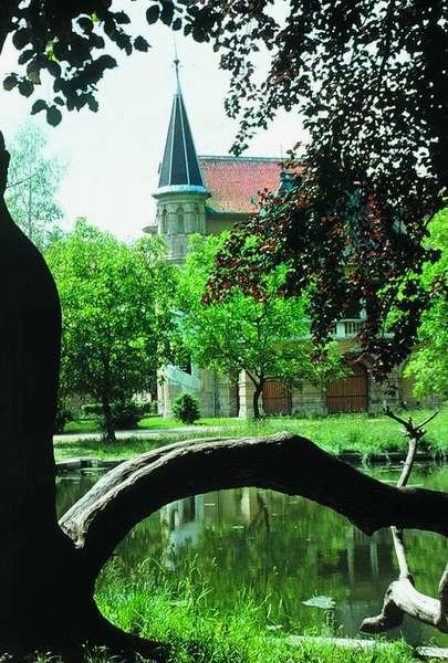
Landmarks
Demographics
According to the 2001 census, the town had 8,063 inhabitants. 96.7% of inhabitants were Slovaks, 1% Czechs and 0.5% Hungarians. The religious makeup was 70.4% Roman Catholics, 19.5% people with no religious affiliation and 2% Lutherans.