
Local time Wednesday 12:18 PM | ||
 | ||
Weather 13°C, Wind S at 21 km/h, 86% Humidity | ||
Stretton is a small, dispersed village in South Staffordshire, England. It is just north of the A5 road in the civil parish of Lapley, Stretton and Wheaton Aston
Map of Stretton, Stafford, UK
The A5 is Watling Street, a notable Roman road, and another Roman road passes through Stretton from Mediolanum (Whitchurch), forming a junction with Watling Street near the bridge over the River Penk. On the other side of the river was the now-deserted Roman settlement of Pennocrucium. The village's position on the road from Mediolanum gives it its name, the Old English for "street town" ("street" meaning a paved or Roman road). Stretton Bridge today carries Watling Street over the Penk.
Stretton Hall is in the village.
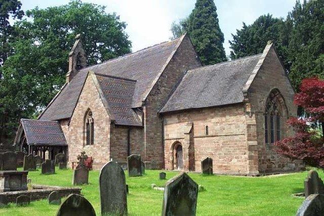
The Church of England parish church of St John's Church, Stretton has a 12th-century chancel.
The Shropshire Union Canal passes to the west of the village, and there is a Stretton Wharf. The Stretton Aqueduct carries the canal over the A5 road.
Vernon Lodge Preparatory School was a small coeducational non-selective independent school in Stretton for children aged 2 to 11. It was founded in 1981 and closed in March 2015.