
Quadrant NW Sector Mature area Elevation 673 m Province Alberta | Ward 8 Area 157 ha Population 8,984 (2012) | |
 | ||
Restaurants Ampersand | 27, El Cortez Mexican Kitchen, Packrat Louie Kitchen, The Next Act, DaDeO Hotels Strathcona Hotel, Metterra Hotel on Whyte, Varscona Hotel on Whyte, Golf 360 Tours | ||
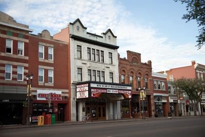
Strathcona is a residential neighbourhood in south central Edmonton, Alberta, Canada. It is a part of, and should not be confused with, Old Strathcona, although much of the Strathcona neighbourhood is in Old Strathcona. The neighbourhood overlooks both the North Saskatchewan River and the Mill Creek Ravine.
Contents
- Map of Strathcona Edmonton AB Canada
- Demographics
- Residential development
- Parks and open spaces
- Strathcona Rail Community Garden
- Population mobility
- References
Map of Strathcona, Edmonton, AB, Canada
According to the neighbourhood description in the City of Edmonton Map utility,
Strathcona was named for Lord Strathcona, Hudson's Bay Company Governor (1889–1914) and the man chosen to drive the "last spike" of the CPR transcontinental railway. The neighbourhood became part of Edmonton when the City of Strathcona amalgamated with Edmonton in 1912. Residents enjoy proximity to Old Strathcona, the University of Alberta, and outdoor recreation in the river valley.
The neighbourhood of Strathcona is bounded on the south by Whyte Avenue, on the north by Saskatchewan Drive, on the west by 107 Street, and on the east by Mill Creek Ravine. Its central location provides good access to downtown Edmonton, Whyte Avenue, the Queen Elizabeth Pool, and other areas of the city.
Demographics
In the City of Edmonton's 2012 municipal census, Strathcona had a population of 7003898400000000000♠8,984 living in 7003592100000000000♠5,921 dwellings, a 0.7% change from its 2009 population of 7003892300000000000♠8,923. With a land area of 1.57 km2 (0.61 sq mi), it had a population density of 7003572230000000000♠5,722.3 people/km2 in 2012.
Residential development
Strathcona was the heart of the City of Strathcona and still is today (although a part of Edmonton) in many cases. According to the 2001 federal census, 15% of residences were built before 1946. Over half the residences (52.6%) were built during the 1960s and 1970s. This is mainly due to a large amount of construction of low-rise apartments near or on Whyte Avenue and 99 St, and high-rise apartments around Saskatchewan Drive in the 1960s, 70s, and 1980s. Despite that, the area, especially around Mill Creek or just off 99 St is still home to a lot of old genuine character homes. Although the number is dwindling due to new infill housing.
Almost half of the residences (44%) are apartments in low-rise buildings with fewer than five stories. A small number of these apartments are owner-occupied condominiums, however most are rented. Another one in four residences (25%) are apartments in high-rise buildings with five or more stories. Roughly one in three high-rise apartments are owner-occupied condominiums with the remaining two in three being rented. Almost one in four (24%) are single-family dwellings. The remaining 7% of residences are a mixture of duplexes, row houses, rooming houses and other types of residence. Overall, three out of every four residences (71%) are rented.
Parks and open spaces
The following are parks located within and adjacent to the Strathcona neighbourhood.
Strathcona Rail Community Garden
In 2009, the Community Garden Network, in conjunction with the City of Edmonton Parks Department, assisted in the conversion of several lots of leased properties to become the Strathcona Rail Community Garden. The lands are immediately south of 86 Avenue and beside the former CPR lands (rail property now owned by the Province of Alberta and leased to the Radial Rail Society). Specifically, Lots 22 to 32 were designated for the purpose of community garden and transferred from Asset Management to Parks. Previous leaseholders from the site who had been gardening there for up to 20 years were invited to be involved in the new community garden and were given first choice of the plots in the new community garden. Plots are open to residents of Strathcona, Queen Alexandra and Garneau.
In 2014, the garden applied to the city to take back the gravel-covered lane adjacent to the garden which had been used as a thoroughfare for several years, but which did not belong to Transportation. After a hearing in front of city council and a couple of public meetings where parking concerns were addressed, a plan for reclaiming the area was developed and implemented. Raised beds were added to enlarge the garden by three members with the potential to accept more gardeners in 2015.
Population mobility
The population in Strathcona is highly mobile. According to the 2005 municipal census, almost three out of every ten residents (28.2%) had moved within the previous 12 months. Another three in ten (27.4%) had moved within the previous one to three years. Only three out of every ten (30.2%) had lived at the same address for five years or more. The high student population in the area, due to the close proximity to the University of Alberta, may account for much of this mobility.