
Country United States County Rockingham Time zone Eastern (UTC-5) Elevation 13 m Population 7,255 (2010) | Incorporated 1716 Area code(s) 603 Zip code 03885 Local time Tuesday 11:02 PM | |
 | ||
Weather 3°C, Wind NW at 3 km/h, 92% Humidity | ||
Stratham is a town in Rockingham County, New Hampshire, United States. The town had a population of 7,255 at the 2010 census, and an estimated population of 7,280 in 2013. It is bounded on the west by the Squamscott River. The town is the home of the only U.S. Lindt & Sprüngli factory and the headquarters of the Timberland Corporation.
Contents
- Map of Stratham NH USA
- History
- Geography
- Demographics
- Politics
- Public safety
- Education
- Notable people
- References
Map of Stratham, NH, USA
History
Stratham was settled in 1631 and incorporated in 1716. The area, called Winnicutt by the Pennacook Indians, was known as Squamscott Patent or Point of Rocks because of its location between Great Bay and the Squamscott River. The sixth town in the colony to be incorporated, the town was named for Wriothesley Russell, Baron Howland of Streatham, a friend of New Hampshire Royal Governor Samuel Shute.
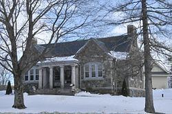
The town is unusual among New England settlements of its size in having been comprehensively mapped in 1793 by Phinehas Merrill. It is therefore possible to identify how many of the extant buildings of the town predate the map.
Each summer the town hosts the Stratham Fair, held at Stratham Hill Park.
Geography
According to the United States Census Bureau, the town has a total area of 15.5 square miles (40 km2), of which 15.1 sq mi (39 km2) is land and 0.4 sq mi (1.0 km2) is water, comprising 2.39% of the town. Stratham is drained by the Squamscott River, a tributary of the Piscataqua River. The highest elevation in town is 290 feet (88 m) above sea level, found on the summits of Stratham Hill and neighboring Jewell Hill.
Stratham Hill Park and nearby Gordon Barker Town Forest offer a combined trail system for hikers and mountain bikers.
Stratham is crossed by New Hampshire Route 33, New Hampshire Route 108 and New Hampshire Route 111.
Demographics
As of the census of 2010, there were 7,255 people, 2,746 households, and 2,045 families residing in the town. The population density was 480.5 people per square mile (185.5/km²). There were 2,864 housing units at an average density of 189.7 per square mile (73.2/km²). The racial makeup of the town was 96.4% White, 0.2% African American, 0.1% Native American, 1.9% Asian, 0.1% Native Hawaiian or Pacific Islander, 0.1% some other race, and 1.2% from two or more races. Hispanic or Latino of any race were 1.3% of the population.
There were 2,746 households out of which 37.7% had children under the age of 18 living with them, 64.0% were headed by married couples living together, 7.6% had a female householder with no husband present, and 25.5% were non-families. 20.4% of all households were made up of individuals, and 6.6% were someone living alone who was 65 years of age or older. The average household size was 2.64, and the average family size was 3.08.
In the town, the population was spread out with 26.4% under the age of 18, 5.0% from 18 to 24, 22.2% from 25 to 44, 34.9% from 45 to 64, and 11.6% who were 65 years of age or older. The median age was 43.3 years. For every 100 females there were 95.0 males. For every 100 females age 18 and over, there were 91.4 males.
For the period 2011-15, the estimated median annual income for a household in the town was $108,306, and the median income for a family was $138,239. Male full-time workers had a median income of $102,315 versus $56,750 for females. The per capita income for the town was $58,137. 0% of families and 0.6% of the population were below the poverty line, including 0% of those under age 18 and 1.8% of those age 65 or over.
Politics
In 2007, 1,901 Stratham residents were registered Republicans, 1,263 voters were registered as Democrats, and 2,710 were registered as undeclared voters.
On June 2, 2011, former Governor Mitt Romney officially opened his presidential campaign in Stratham, due to the political weight that New Hampshire carries throughout the primaries.
Public safety
Stratham has an all-volunteer fire department located in a new building at the intersection of Winnicut Road and Portsmouth Avenue (NH 33) next to the Stratham Historical Society.
Education
Stratham is home to the Cooperative Middle School, 100 Academic Way and Stratham Memorial School, 39 Gifford Farm Road. High school students from Stratham attend Exeter High School.