
- summer (DST) CEST (UTC+2) Area 31.4 km² Team TJ Jiskra Strážnice | Elevation 177 m Local time Wednesday 10:31 PM | |
 | ||
Weather 14°C, Wind W at 5 km/h, 52% Humidity Points of interest Skanzen, Baťův kanál, Muzeum vesnice Jihových, Průžkův mlýn, Osypané břehy | ||
Str nice hodon n district
Strážnice (German: Straßnitz) is a town in Hodonín District, South Moravian Region, Czech Republic. It has a population of 5,829 (2006 est.). It is located in Slovácko microregion.
Contents
Map of 696 62 Str%C3%A1%C5%BEnice, Czechia
Items from the Neolithic Linear Pottery culture have been found in the area.
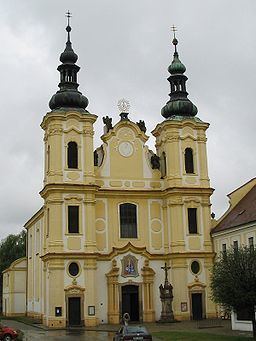
The Strážnice Castle – originally a water castle – was founded in the second half of the 13th century, later rebuilt in Renaissance style. Positioned at the river Morava, it served as a guarding point on Hungarian border. Nowadays, the National Institute of Folk Culture resides here. There is a permanent exposition of "Folk instruments of the Czech Republic" and the Castle library. The castle is surrounded by an informal park with the longest plane alley in Central Europe founded in the first half of the 19th century. Amphitheatres, a summer cinema, lakes, a dendrology path with educational boards and many benches are located in the park. The Jewish cemetery in Sadova street holds about 1100 gravestones, the oldest ones dating back to 17th century. The synagogue rebuilt in early 20th century has been recently renovated in mid-2008 and is an adjunct to the local museum. Most of the Straznice Jews were deported to their deaths in the Holocaust but many of the houses in the old ghetto still stand. The roads leading to neighbouring towns of Veselí nad Moravou and Skalica are flanked by massive early-16th century bastions.