
Country United States County Allegheny ZIP codes 15136 Local time Tuesday 5:07 PM Area code 412 | State Pennsylvania Time zone Eastern (EST) (UTC-5) Zip code 15136 Population 6,362 (2010) | |
 | ||
Weather 13°C, Wind NW at 18 km/h, 83% Humidity Area 6.216 km² (5.18 km² Land / 78 ha Water) Neighborhoods Island Heights, Stowe Township, Pittock, West Park, Stowe Township | ||
Stowe Township is a township in Allegheny County, Pennsylvania, United States. The population was 6,362 at the 2010 census.
Contents
- Map of Stowe Township PA USA
- Geography
- Neighborhoods
- Surrounding communities
- Demographics
- Notable residents
- References
Map of Stowe Township, PA, USA
It is located in the Sto-Rox School District, which serves both Stowe Township and the neighboring borough of McKees Rocks.
Stowe Township has partnered with the Allegheny Together organization to revitalize its main business district on Broadway Avenue.
The area is well served by Port Authority bus routes 21A, 21B, 21C, 21D, 21F, CO, and 24A.
Geography
Stowe Township is located at 40°28′46″N 80°4′26″W (40.479668, -80.07389).
According to the United States Census Bureau, the township has a total area of 2.3 square miles (6.0 km2), of which 2.0 square miles (5.2 km2) is land and 0.4 square miles (1.0 km2), or 15.38%, is water.
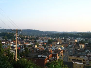
Neighborhoods
Surrounding communities
Stowe Township is bordered by Kennedy Township to the west and McKees Rocks to the south. To the northeast, across the Ohio River, are the Pittsburgh neighborhood of Brighton Heights and the boroughs of Bellevue and Avalon. Neville Island in the Ohio River is to the north, via the Fleming Park Bridge.
Demographics
As of the census of 2000, there were 6,706 people, 3,061 households, and 1,805 families residing in the township. The population density was 3,391.4 people per square mile (1,307.7/km²). There were 3,556 housing units at an average density of 1,798.3/sq mi (693.4/km²). The racial makeup of the township was 90.44% White, 8.04% African American, 0.21% Native American, 0.16% Asian, 0.22% from other races, and 0.92% from two or more races. 0.42% of the population were Hispanic or Latino of any race.
There were 3,061 households, out of which 21.9% had children under the age of 18 living with them, 38.0% were married couples living together, 15.8% had a female householder with no husband present, and 41.0% were non-families. 36.3% of all households were made up of individuals, and 16.7% had someone living alone who was 65 years of age or older. The average household size was 2.17 and the average family size was 2.83.
In the township the population was spread out, with 19.9% under the age of 18, 7.2% from 18 to 24, 27.1% from 25 to 44, 22.7% from 45 to 64, and 23.1% who were 65 years of age or older. The median age was 42 years. For every 100 females there were 87.9 males. For every 100 females age 18 and over, there were 84.7 males.
The median income for a household in the township was $29,688, and the median income for a family was $36,688. Males had a median income of $31,151 versus $28,221 for females. The per capita income for the township was $17,783. About 9.0% of families and 13.3% of the population were below the poverty line, including 19.2% of those under age 18 and 8.0% of those age 65 or over.