
Listing TuMP OS grid SX257724 Elevation 381 m | Prominence 78 m | |
 | ||
Topo map OS Landranger 201, Explorer 109 Similar Kilmar Tor, Rough Tor, Brown Willy, Alex Tor, Brown Gelly | ||
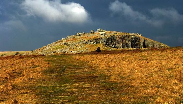
Stowe's Hill is an elongated hill, 381 metres (1,250 ft) high, located on the eastern edge of Bodmin Moor in the county of Cornwall, England.
Map of Stowe's Hill, Liskeard, UK
Stowe's Hill is a prominent granite ridge located about 1500 metres north of Minions, the highest village in Cornwall. It is dominated by Stowe's Pound, a huge tor enclosure comprising two massive stone-walls. The smaller enclosure surrounds the tors at the southern end of the hill; the larger one encircles the rest of the ridge. At the southern end is a large, disused quarry, but the hill is best known as the site of the Cheesewring, the extraordinary granite formation that gave the quarry its name.
Inside Stowe's Pound are two Bronze Age cairns, a stone round house and over 100 house platforms. The site is thought to be Neolithic or Bronze Age and connected with other settlements and ritual monuments in the vicinity.