
OS grid reference TQ086142 Post town PULBOROUGH Dialling code 01903 | Sovereign state United Kingdom Area 12 km² | |
 | ||
Population 6,074 2001 Census6,966 (2011 Census) Points of interest Storrington & District Museum, Sandgate Park, Kithurst Hill, Storrington Memorial Pond, WWII Churchill MkII Tank | ||
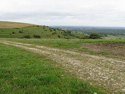
Storrington and Sullington is the name of a civil parish in the Horsham District of West Sussex, England. The two villages are near the A24 road sixteen miles (26 km) south of Horsham.
Map of Storrington and Sullington, UK
The civil parish has a land area of 1200 hectares (2963 acres). In the 2001 census 6074 people lived in 2778 households of whom 2563 were economically active. At the 2011 Census the population had increased to 6,966.
References
Storrington and Sullington Wikipedia(Text) CC BY-SA