
- elevation 1,463 ft (446 m) - average 442 cu ft/s (13 m/s) Mouth Sacramento River | - elevation 108 ft (33 m) Basin area 2,002 km² Country United States of America | |
 | ||
- location Stonyford, Colusa County - location Hamilton City, Glenn County - max 39,900 cu ft/s (1,130 m/s) | ||
Stony Creek is a moderate sized river in north-central California in the United States, and is a tributary of the Sacramento River. It is 65.6 miles (105.6 km) long and its watershed encompasses 773 square miles (2,000 km2). The stream rises in the eastern foothills of the California Coast Ranges and flows generally northeast to where it drains into the Sacramento near Hamilton City, in the middle of the Sacramento Valley. The average discharge of the creek, about 400 cubic feet per second (11 m3/s), ranges from between 50 cubic feet per second (1.4 m3/s) in drought to 1,000 cubic feet per second (28 m3/s) in wet years. The maximum discharge was 39,900 cubic feet per second (1,130 m3/s) on February 24, 1957.
Contents
Map of Stony Creek, California, USA
CourseEdit
It rises at the confluence of its North, Middle and South Forks in the eastern Coast Ranges, about 5 miles (8.0 km) west of the town of Stonyford. All three forks flow within the Mendocino National Forest. The North Fork, about 7.5 miles (12.1 km) long, rises near St. John Mountain and travels in a southeasterly direction. The Middle Fork rises on the west flank of Snow Mountain and arcs around eastwards, flowing for about 8 miles (13 km). The South Fork, some 6.5 miles (10.5 km) long, begins near Goat Mountain and flows first northwest then northeast to the confluence of the three forks where the main stem of Stony Creek begins.
Stony Creek flows swiftly eastwards out of the mountains, into Indian Valley, turning north at Stonyford. It receives Little Stony Creek from the right as it passes between a pair of low ridges. The creek then widens into long, narrow Stony Gorge Reservoir, which is formed by the Stony Gorge Dam. It continues north past the town of Elk Creek, where it receives a tributary of the same name from the left. Flowing between California State Route 162 and a low eastern ridge of the Coast Ranges, it then receives Grindstone Creek, its main tributary, near Grindstone Rancheria.
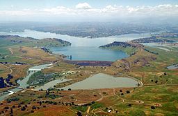
The two rivers flow into each other almost in opposite directions; the waters then flow northeastwards, through a broad shallow valley of the Coast Range foothills. Stony Creek then enters Black Butte Lake, a large reservoir formed by the earthen Black Butte Dam. The intermittent North Fork Stony Creek (not to be confused with the headstream further south) joins Stony Creek in the reservoir. After exiting the dam Stony Creek flows southeast into the Sacramento Valley. It passes under Interstate 5 and about 1 mile (1.6 km) north of Orland. Large amounts of water are diverted from it to irrigate the many farms along its course. Near Hamilton City most of its remaining flow is diverted into the Glenn-Colusa Canal. The remnants of the creek continue southeast to join the Sacramento some 5 miles (8.0 km) southwest of Chico.