
Country United States FIPS code 36-71410 Elevation 116 m Local time Tuesday 4:53 AM | State New York Time zone Eastern (EST) (UTC-5) GNIS feature ID 0979528 Population 3,665 (2010) | |
 | ||
Weather 5°C, Wind E at 5 km/h, 95% Humidity Area 244.2 km² (243.2 km² Land / 78 ha Water) | ||
Stockholm is a town in St. Lawrence County, New York, United States. The population was 3,665 at the 2010 census. The name was assigned by surveyors from Stockholm in Sweden.
Contents
Map of Stockholm, NY, USA
The Town of Stockholm is in the northeast part of the county and is northeast of Potsdam.
History
Stockholm was erected from part of the Town of Massena by a legislative act passed February 21, 1806. It received its name by the surveyors from Stockholm, Sweden. It retained its original territory until April 9, 1823, when a part was annexed to Norfolk, and on April 15, 1834, another portion was annexed to the same town. During the War of 1812 some residents left the town and a lesser number returned.
Geography
According to the United States Census Bureau, the town has a total area of 94.3 square miles (244 km2), of which, 93.9 square miles (243 km2) of it is land and 0.3 square miles (0.78 km2) of it (0.37%) is water.
The St. Regis River flows northward through the east part of the town.
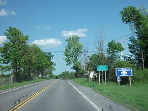
U.S. Route 11 passes through the town. New York State Route 420 crosses the northeast corner of the town.
Demographics
As of the census of 2000, there were 3,592 people, 1,381 households, and 999 families residing in the town. The population density was 38.2 people per square mile (14.8/km²). There were 1,520 housing units at an average density of 16.2 per square mile (6.2/km²). The racial makeup of the town was 97.91% White, 0.33% African American, 0.42% Native American, 0.19% Asian, 0.14% from other races, and 1.00% from two or more races. Hispanic or Latino of any race were 0.50% of the population.
There were 1,381 households out of which 35.8% had children under the age of 18 living with them, 57.0% were married couples living together, 10.0% had a female householder with no husband present, and 27.6% were non-families. 22.4% of all households were made up of individuals and 8.6% had someone living alone who was 65 years of age or older. The average household size was 2.60 and the average family size was 3.01.
In the town, the population was spread out with 27.6% under the age of 18, 8.3% from 18 to 24, 28.3% from 25 to 44, 23.6% from 45 to 64, and 12.3% who were 65 years of age or older. The median age was 36 years. For every 100 females there were 98.8 males. For every 100 females age 18 and over, there were 93.7 males.
The median income for a household in the town was $30,720, and the median income for a family was $38,370. Males had a median income of $30,444 versus $21,821 for females. The per capita income for the town was $15,109. About 11.2% of families and 16.0% of the population were below the poverty line, including 25.3% of those under age 18 and 6.2% of those age 65 or over.