
River system Oder Basin area 220 km² | Basin size 220 km² Country Germany | |
 | ||
Location District Märkisch-Oderland, Brandenburg, Germany Main source Ursprung: Rotes Luch on the Drainage divide between the Baltic Sea and the North Sea
48 m River mouth nearby Altfriedland confluence with the Quappendorfer Kanal to the Friedländer Strom
5 m Progression Friedländer Strom → Alte Oder → Hohensaaten-Friedrichsthaler Wasserstraße → Oder → Stettiner Haff | ||
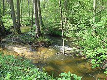
The Stobber (in German more often called Stöbber) is the central river in the hilly landscape of „Märkische Schweiz“ and the Märkische Schweiz Nature Park, Brandenburg, Germany. The stream runs over a distance of 25 kilometers from the fen and source region of Rotes Luch towards the northeast through Buckow to the Oderbruch. The Stobber flows at Neuhardenberg to the „Friedländer Strom“, whose waters run over some canals to the Oder River → Baltic Sea. On a roughly 13 kilometer long route of its course there is designated the nature protection area „Naturschutzgebiet Stobbertal“. In Altfriedland the river passes the Damm-Mühle (water mill) and, directly alongside the Kietzer See (lake), a Special European Protection Area (SPA) for the conservation of wild living birds (Birds Directive).