
Country United States County Coos Time zone Eastern (UTC-5) Elevation 360 m Population 1,004 (2010) | Incorporated 1795 Area code(s) 603 Zip code 03576 Local time Monday 7:26 PM | |
 | ||
Weather 1°C, Wind SE at 10 km/h, 90% Humidity | ||
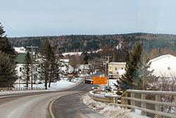
Stewartstown is a town in Coos County, New Hampshire, United States. The population was 1,004 at the 2010 census. It includes the village of West Stewartstown and is part of the Berlin, NH–VT Micropolitan Statistical Area.
Contents
Map of Stewartstown, NH 03576, USA
History
Stewartstown was granted in 1770 and incorporated in 1795. Originally named Stuart after Sir John Stuart, it was incorporated as Stewartstown after the Revolutionary War, following the original Scottish spelling of the name.
Geography
According to the United States Census Bureau, the town has a total area of 46.8 square miles (121 km2), of which 46.2 square miles (120 km2) is land and 0.6 square miles (1.6 km2) is water, comprising 1.23% of the town. The highest point is the summit of Sugar Hill, at 2,985 feet (910 m) above sea level, near the town's southeastern corner.
The primary settlement in the town is the village of West Stewartstown on U.S. Route 3 along the Connecticut River, opposite the town of Canaan, Vermont. Stewartstown village is a mile northeast of West Stewartstown, along Route 3 and opposite the village of Beecher Falls, Vermont. To the east, the village of Stewartstown Hollow is closer to the geographic center of the town, along New Hampshire Route 145.
Demographics
As of the census of 2000, there were 1,012 people, 371 households, and 241 families residing in the town. The population density was 21.8 people per square mile (8.4/km²). There were 760 housing units at an average density of 16.4 per square mile (6.3/km²). The racial makeup of the town was 99.11% White, 0.10% Native American, and 0.79% from two or more races. Hispanic or Latino of any race were 0.10% of the population.
There were 371 households out of which 31.5% had children under the age of 18 living with them, 50.4% were married couples living together, 7.8% had a female householder with no husband present, and 34.8% were non-families. 27.8% of all households were made up of individuals and 9.7% had someone living alone who was 65 years of age or older. The average household size was 2.42 and the average family size was 2.91.
In the town, the population was spread out with 23.1% under the age of 18, 7.5% from 18 to 24, 27.3% from 25 to 44, 24.4% from 45 to 64, and 17.7% who were 65 years of age or older. The median age was 39 years. For every 100 females there were 106.1 males. For every 100 females age 18 and over, there were 106.9 males.
The median income for a household in the town was $30,700, and the median income for a family was $34,911. Males had a median income of $29,286 versus $21,313 for females. The per capita income for the town was $17,231. About 9.0% of families and 11.5% of the population were below the poverty line, including 12.3% of those under age 18 and 14.4% of those age 65 or over.