
Population 60 (2013 estimate) Civil parish Steeple Local time Monday 5:02 AM | OS grid reference SY910812 Sovereign state United Kingdom Dialling code 01929 | |
 | ||
Weather 6°C, Wind NE at 14 km/h, 91% Humidity | ||
Steeple is a hamlet and civil parish in the Purbeck district of the English county of Dorset. It is situated 8 miles (13 km) west of the coastal resort town of Swanage at the foot of Ridgeway Hill. In 2013 the estimated population of the civil parish was 60.
Map of Steeple, UK
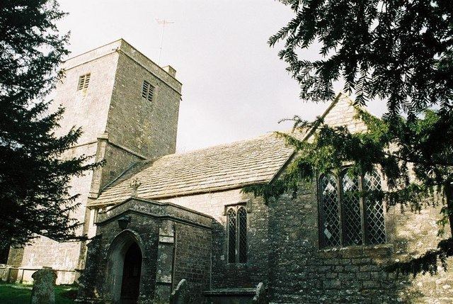
The ancient Norman church of Steeple, dedicated to St Michael and All Angels, ironically lacks a steeple. It has a coat of arms engraved in stone in the porch and another painted in scarlet of the roof interior that is precisely the same as George Washington's coat of arms, showing stars and stripes.
The Washington arms is quartered with those of the squires of Steeple village, the Lawrence family, who are allied with the Washingtons by the marriage of one of its sons, Edmund Lawrence, to Agnes de Wessington in 1390.
The flag of the US capital hangs inside the church, presented on 25 July 1977 by Walter E Washington, Mayor of Washington DC from 2 January 1975 - 2 January 1979
On the highest local point of the nearby Purbeck Ridge is an 18th-century folly built by the former owner of Creech Grange and known as Grange Arch. Today it is a Grade II listed building owned by the National Trust.