
Country United States GNIS feature ID 2582718 | FIPS code 02-72985 Elevation 152 m | |
 | ||
Area 240.5 km² (240.5 km² Land / 1 ha Water) | ||
Steele Creek is a census-designated place (CDP) in Fairbanks North Star Borough, Alaska, United States. It is part of the Fairbanks, Alaska Metropolitan Statistical Area. As of the 2010 census, the population was 6,662 (15th place in list of cities and census-designated places of Alaska).
Contents
Geography
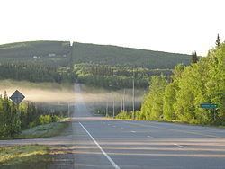
Steele Creek is located northeast of Fairbanks and east of the Steese Highway. The community is named for the creek which flows from north to south across the western part of the CDP, rising on Tungsten Hill and flowing towards the Chena River. The CDP extends east as far as the Little Chena River and Iowa Creek. The CDP is bounded by Two Rivers to the east, Badger to the south, Fairbanks to the southwest, Farmers Loop to the west, and Fox to the northwest.
According to the U.S. Census Bureau, the Steele Creek CDP has a total area of 92.9 square miles (240.5 km2), of which 0.004 square miles (0.01 km2), or 0.01%, is water.
Demographics
As of the census of 2010, there were 6,662 people, 2,525 households, and 1,806 families residing in the CDP. There were 2,743 housing units. The racial makeup of the CDP was 87.4% White, 0.8% Black or African American, 3.8% Native American, 0.9% Asian, 0.2% Pacific Islander, 1.1% from other races, and 5.9% from two or more races. 3.2% of the population were Hispanic or Latino of any race.