
NRHP Reference # 96000062 Year built 1932 | Area 2 ha Added to NRHP 21 February 1996 | |
 | ||
Location Stedman, Thomas, Inman, Brown, and Tatsudu Sts., Ketchikan, Alaska | ||
Stedman thomas historic district top 8 facts
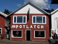
The Stedman-Thomas Historic District encompasses what was historically the southern portion of Ketchikan, Alaska. It extends along Stedman and Thomas Streets, from Ketchikan Creek in the north to East Street in the south, and includes a few properties on adjacent spur side streets. In the early days of the city, the area was a seasonal Native fishing camp just south of the creek, but the Alaskan gold rushes around the turn of the 20th century brought an influx of settlers to the area. Foreign workers and Natives generally lived south of the creek, and the area became known as Indian Town. As the town expanded in this area, commercial and residential buildings were built on pilings, something that only gradually began to change when fill was brought into Stedman Street in the 1930s. Most of the buildings on this stretch of Stedman Street were built between about 1900 and 1930, and are vernacular wood-frame structures. The commercial buildings facing Stedman Street generally have false fronts, which hide their gable roofs. The district include's Ketchikan's oldest continuously-operating retail establishment, Ohashi's, which is located at 223 Stedman Street.
The district was listed on the National Register of Historic Places in 1996.