
West end: Datça | Length 2,057 km | |
 | ||
East end: Road 16 at Serow, West Azarbaijan | ||
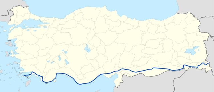
D-400 is an east–west state road in southern Turkey. The 2,057-kilometre (1,278 mi) road starts at Datça in the southwest corner of the Anatolian peninsula. The road ends at the Iranian border at Esendere.
Contents
Map of D400, Turkey
D-400 runs through the cities of Marmaris, Fethiye, Antalya, Alanya, Mersin, Adana, Gaziantep, Şanlıurfa, and Hakkâri and links to Road 16 in Iran. Between Nizip and Cizre, D-400 is part of the European route .
Itinerary
In the table below the locations between Datça and Esendere are shown.
References
State road D400 (Turkey) Wikipedia(Text) CC BY-SA