
Length 1,427 km | ||
 | ||
West end: Karasu, Sakarya Province East end: Akçakale, Kars Province | ||
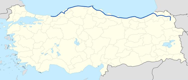
D-010, aka Black Sea Coastal Road, is a major west-east state road in northern Turkey that serves the Black Sea coast. The 1,427 km (887 mi) route starts in the west at the intersection , 5 km (3.1 mi) southeast of Karasu, Sakarya Province, and terminates at the intersection , 25 km (16 mi) northeast of Kars in eastern Anatolia. However, it is discontinued between Zonguldak and 10 km (6.2 mi) southwest of Çaycuma. The gap of 37 km (23 mi) distance is on the highway .
Contents
Map of D010, Turkey
Connecting most of the coastal towns and cities at middle and eastern Black Sea, D-010 runs through Ereğli, Zonguldak, Bartın, Sinop, Samsun, Ordu, Giresun, Trabzon and Rize. It leaves the coast at Hopa, Artvin Province and turns southeast. D-010 passes through Ardahan and connects at Akçakale, Kars Province to , which leads in the east to the border checkpoint Turkey-Armenia at Akyaka, Kars. On its full length, it passes through 14 provinces of Turkey.
Between Samsun and Hopa, D-010 is a divided route named Black Sea Coastal Highway (Turkish: Karadeniz Sahil Yolu), and is part of the European route at a length of 480 km (300 mi).
Itinerary
In the table below the locations between Karasu and Sarp are shown.