
Time zone Mountain (MST) (UTC-7) Elevation 1,940 m Population 57 (2012) | Incorporated March 2, 1954 Area code(s) 719 Zip code 81082 Local time Sunday 3:49 AM | |
 | ||
Weather 6°C, Wind SW at 16 km/h, 56% Humidity | ||
Starkville is a Statutory Town in Las Animas County, Colorado, United States. The population was 59 at the 2010 census. It is only one of two places in the United States named Starkville. The other being Starkville, Mississippi, which was named in honor of Revolutionary War hero General John Stark and is home of Mississippi State University.
Contents
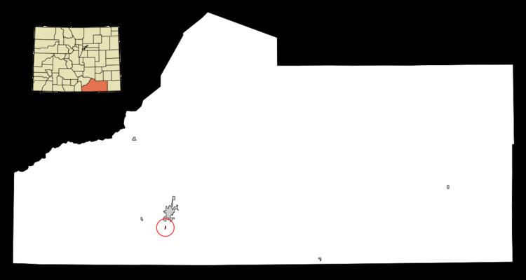
Map of Starkville, CO 81082, USA
History
The town was named for Albert G. Stark, a coal mine owner.
Geography
Starkville is located at 37°7′0.5520″N 104°31′23.8728″W (37.116820, -104.523298).
According to the United States Census Bureau, the town has a total area of 0.1 square miles (0.26 km2), all of it land.
Demographics
2010
As of the census of 2010, there were 59 people, 26 households, and 30 families residing in the town. There were 35 housing units. The racial makeup of the town was 55.9% White, 1.7% Native American, 37.3% from other races, and 3.4% from two or more races. Hispanic or Latino of any race were 72.9% of the population.
There were 26 households out of which 23.1% had children under the age of 18 living with them, 46.2% were married couples living together, 11.5% had a female householder with no husband present, and 34.6% were non-families. 30.8% of all households were made up of individuals and 11.5% had someone living alone who was 65 years of age or older. The average household size was 2.27 and the average family size was 2.76.
In the town, the population was spread out with 22.1% under the age of 19, 6.8% from 20 to 24, 22.1% from 25 to 44, 35.7% from 45 to 64, and 13.6% who were 65 years of age or older. The median age was 44.5 years.
The median income for a household in the town was $46,250, and the median income for a family was $51,250.
2000
As of the census of 2000, there were 128 people, 42 households, and 30 families residing in the town. The population density was 1,245.1 people per square mile (494.2/km²). There were 53 housing units at an average density of 515.6 per square mile (204.6/km²). The racial makeup of the town was 71.88% White, 3.91% Native American, 14.84% from other races, and 9.38% from two or more races. Hispanic or Latino of any race were 64.06% of the population.
There were 42 households out of which 31.0% had children under the age of 18 living with them, 61.9% were married couples living together, 9.5% had a female householder with no husband present, and 26.2% were non-families. 21.4% of all households were made up of individuals and 11.9% had someone living alone who was 65 years of age or older. The average household size was 3.05 and the average family size was 3.55.
In the town, the population was spread out with 27.3% under the age of 18, 10.2% from 18 to 24, 26.6% from 25 to 44, 25.8% from 45 to 64, and 10.2% who were 65 years of age or older. The median age was 35 years. For every 100 females there were 96.9 males. For every 100 females age 18 and over, there were 106.7 males.
The median income for a household in the town was $42,708, and the median income for a family was $50,000. Males had a median income of $30,417 versus $19,844 for females. The per capita income for the town was $14,297. There were 5.3% of families and 10.1% of the population living below the poverty line, including 18.2% of under eighteens and 22.2% of those over 64.