
Postal code 378 81 to 378 82 Elevation 545 m | Time zone CET (UTC+1) NUTS 5 (municipality) CZ0313 547212 Area 69.19 km² | |
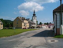 | ||
Staré Město pod Landštejnem is a village and municipality (obec) in Jindřichův Hradec District in the South Bohemian Region of the Czech Republic.
Map of Star%C3%A9 M%C4%9Bsto pod Land%C5%A1tejnem, Czechia
The municipality covers an area of 69.19 square kilometres (26.71 sq mi), and has a population of 490 inhabitants as of 1January 2014.
Staré Město pod Landštejnem lies approximately 27 kilometres (17 mi) south-east of Jindřichův Hradec, 58 km (36 mi) east of České Budějovice, and 137 km (85 mi) south-east of Prague.
References
Staré Město pod Landštejnem Wikipedia(Text) CC BY-SA