
Population 110 Sovereign state United Kingdom Local time Sunday 2:11 AM | OS grid reference SY401924 | |
 | ||
Weather 7°C, Wind NE at 21 km/h, 45% Humidity | ||
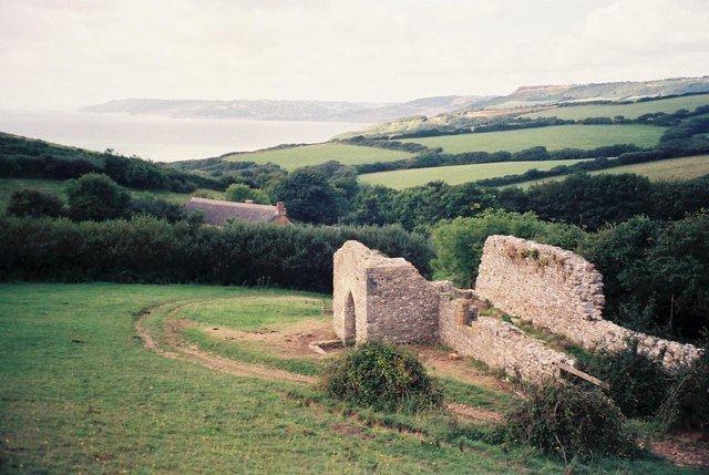
Stanton St Gabriel is a civil parish in west Dorset, England. It lies approximately midway between the towns of Lyme Regis and Bridport on the Jurassic Coast World Heritage Site, and includes within its boundary the highest cliff on the south coast of England, Golden Cap. In 2013 the estimated population of the parish was 110. The population in 1921 was 54.
Map of Stanton St. Gabriel, UK
In 1086 Stanton St Gabriel was described in the Domesday Book as "Stantone", a derivation from Old English meaning "farm on stoney ground". The old settlement had become virtually deserted by the 18th century; the inhabitants had moved either a short distance inland, where the new Dorchester to Exeter turnpike road had been rerouted, or to Bridport, where work was available in its ropewalks.
Writing in 1906, Sir Frederick Treves described Stanton St Gabriel as "a village which was lost and forgotten centuries ago." He stated that all that remained of the settlement was "an ancient farmhouse, in a state of musty decay, and a cottage. Close to the farm and encumbered with its litter are the ruins of the village church."