
OS grid reference TL396224 Sovereign state United Kingdom | Civil parish Standon Dialling code 01920 | |
 | ||
Population 4,141 (Parish, 2001)4,335 (2011 Census including Old Hall Green and Wellpond Green) | ||
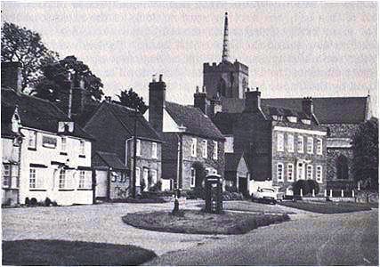
Standon is a village and civil parish in Hertfordshire, England. The parish includes the adjoining village of Puckeridge. The village church of St Mary has Saxon origins with much Victorian restoration. It contains the ornate tomb of the Tudor courtier Sir Ralph Sadler.
Map of Standon, Ware, UK
The Prime Meridian passes to the west of Standon.
The place-name is first attested in a Saxon charter of 944-6 AD and means 'stony hill'.
Standon village has many local facilities. In addition to the church, there is a village hall, two public houses, a Chinese restaurant, post office, butcher, baker, and newsagent. Villagers also make frequent use of facilities in neighbouring Puckeridge, which include a pharmacy, estate agent, petrol station, public houses, doctor's surgery and primary schools (including St Thomas of Canterbury, a Roman Catholic primary school).