
Time zone PST (UTC+5) | Tehsil Roundu Valley Website www.travelpk.org | |
 | ||
Stak Valley (Urdu: استک نالہ, Balti: སྟཀ ནལ་) is a valley in the Roundu Subdivision of District Skardu, Gilgit-Balitistan, Pakistan. The valley is on the right bank of the Indus River, Pakistan’s longest river, between Skardu and Giligit city. The valley is the biggest valley in term of area and population in Roundu subdivision. The valley has been one of the very important regions of the area in term of in history and of geological formation as well.
Geography
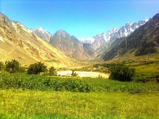
Stak Valley is situated in the middle of Skardu and Gilgit city on the right bank of the Indus River and Gilgit-Skardu Road. In the east of the Stak Valley lies the Askore valley and Thwar Valley. In the west are the Tooklano and Chamachoo. In the south there are the Indus River and Ganji Valley across the Indus River. In the north and northwest there is the Haramosh and Kutia Glacier. In the northeast is the Goropha galacier.
The prominent landmarks around the Stak valley are: Kutia Lungma Glacier, Goropha Glacier (which joins the Chogo Lungma Glacier) , Haramosh Peak (7,397 m, 24,270 ft), Parabar Peak (60,321 m 20,740 ft), Stak-La (Stak Mountain Pass 4,601 m, 15,491 ft) and some other peaks (Shinka, Mashika, Korang Kar) which are about 6,000 m (20,000 ft). The Stak River originates from the Stak-La and joins by Goropha, Kutia and Tooklano Streams and falls in Indus River after completing a course of about 30 km. The Stak River bisects the Stak Valley. According to the geologist most of the villages are formed by the moraines, although the valley is one of the fertile valleys of the Roundu Subdivision.