
Country United States ZIP code 97062 Area 15.7 km² Local time Saturday 7:07 AM | Time zone Pacific (PST) (UTC-8) Population 1,577 (2010) | |
 | ||
Weather 5°C, Wind SW at 3 km/h, 97% Humidity | ||
Stafford is an unincorporated community, classified as a hamlet, in Clackamas County, Oregon, United States. It is a census-designated place (CDP), with a population of 1,577 as of the 2010 census. The community covers approximately 15.7 km2 (3,900 acres) located in a rough triangle south of Lake Oswego, east of Tualatin, and west of West Linn. Students in the area attend the schools of the West Linn-Wilsonville School District.
Contents
Map of Stafford, OR 97062, USA
History
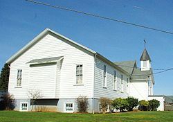
Stafford was named by George A. Steel, a prominent Portland pioneer, after his hometown of Stafford, Ohio, in the 1860s. The Stafford School opened in the community in 1892, and the following year the Eastside Electric Railway owned by Steel reached the area. In 1895, the Wanker family moves to the area and buys land where they build a store and tavern, an area later to become Wankers Corner.
Parts of the area were proposed to be added to the Portland area's urban growth boundary in 1995. Eventually 830 acres (3.4 km2) were added, but later removed after a court fight that ended in 2001 at the Oregon Court of Appeals. In November 2006, the residents of Stafford voted 344-30 to form a hamlet, the second Oregon community to do so (after Beavercreek).